
Big Island, Arkansas
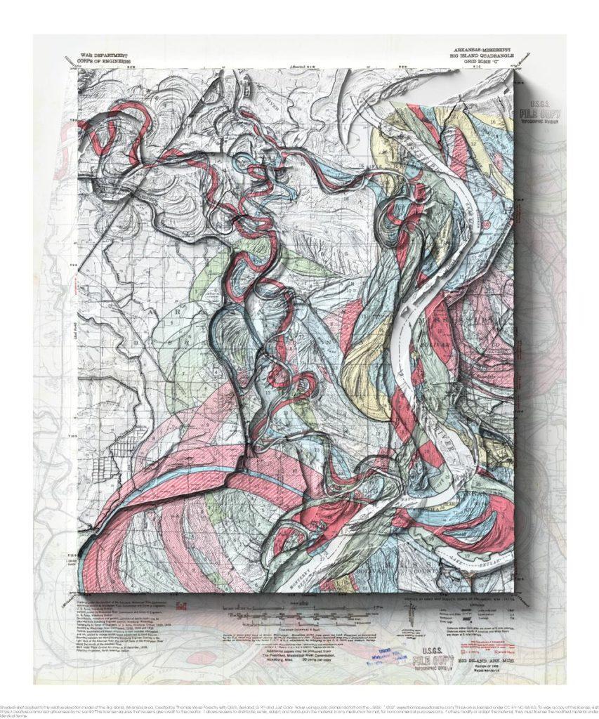
1944 Fisk Mississippi River meander map and 1927 USGS 1:62,500 topographic map with shaded relief in 20″ x 24″ layout. This is part of a series of maps show the major tributaries of the Mississippi River. This map depicts of the confluence of the Arkansas River. The Fisk meander maps are oriented to the river […]
St. Charles, Missouri
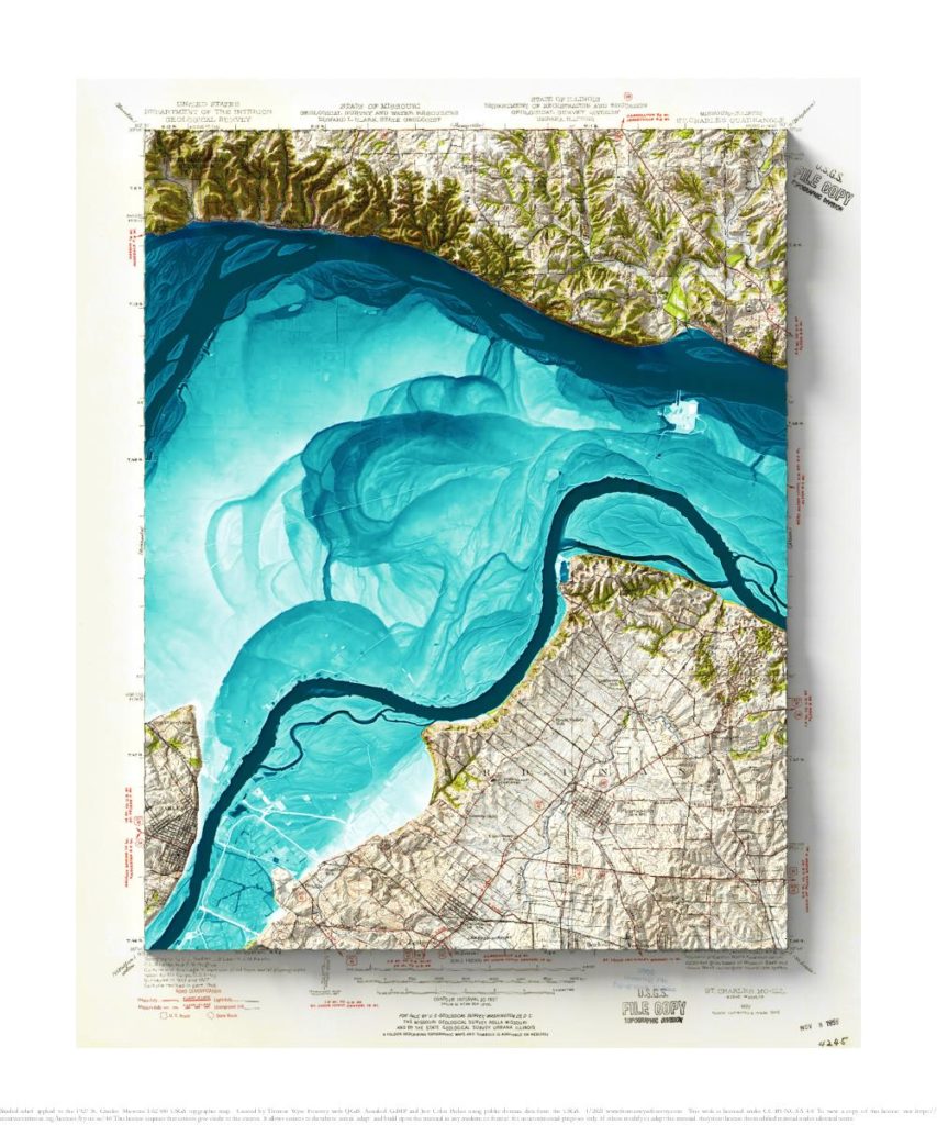
1927 USGS 1:62,500 topographic map with shaded relief in 20″ x 24″ layout. This is part of a series of maps show the major tributaries of the Mississippi River. This map depicts of the confluence of the Illinois River, and it also shows the Missouri river just upstream of the confluence. I never realized how […]
Alton, Illinois
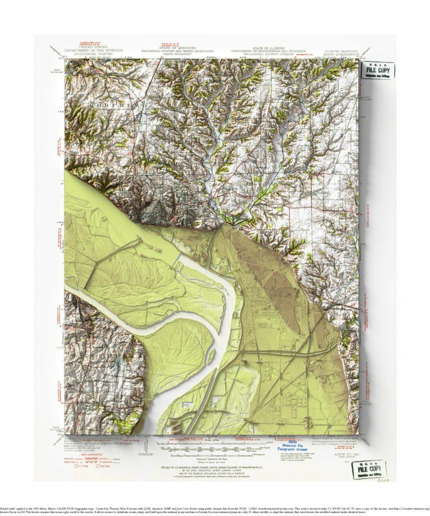
1927 USGS 1:62,500 topographic map with shaded relief in 20″ x 24″ layout. This is part of a series of maps show the major tributaries of the Mississippi River. This map depicts of the confluence of the Missouri River. The Illinois River joins the Mississippi River just upstream of the Missouri. I never realized how […]
Cairo, Illinois
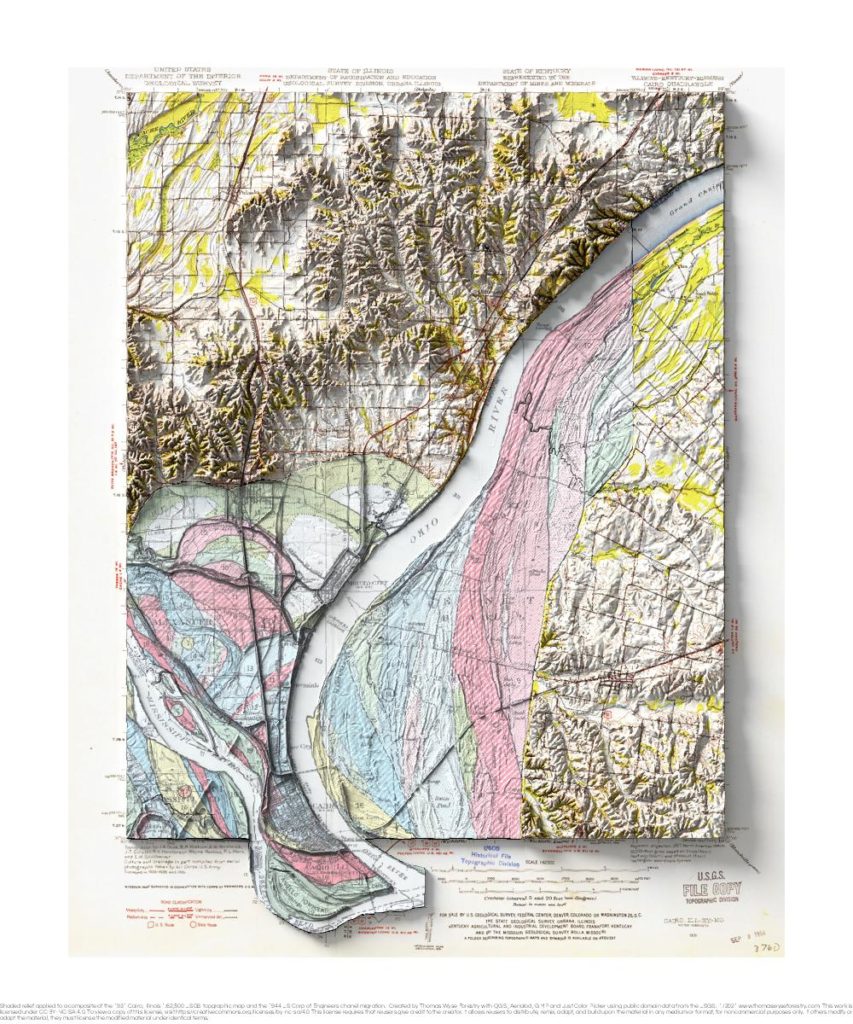
1931 USGS 1:62,500 topographic map with shaded relief in 20″ x 24″ layout. This is part of a series of maps that show the major tributaries of the Mississippi River. This map shows the confluence of the Ohio River, and it includes a portion of the 1944 Fisk map of river meanders over time. This […]
Artonish, Louisiana
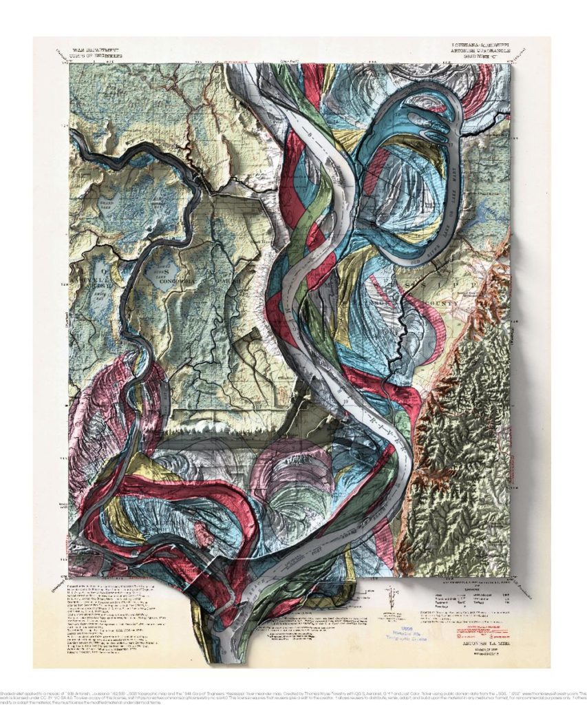
1939 USGS 1:62,500 topographic map with shaded relief in 20″ x 24″ layout. This is part of a series of maps that show the major tributaries and distributaries of the Mississippi River. This map was made prior when the Lower Old River was closed and a controlled outflow channel was created in 1963. The controlled […]
Memphis, Tennessee
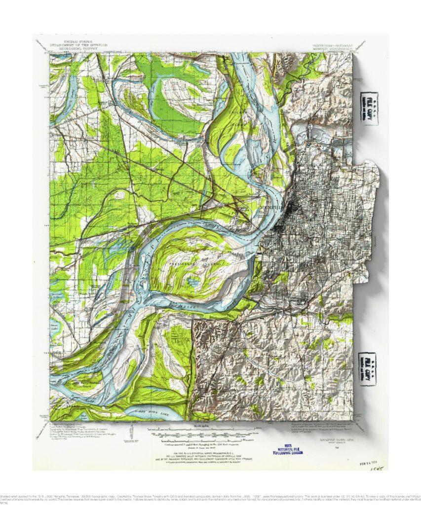
1913 USGS 1:62,500 topographic map with shaded relief in 20″ x 24″ layout. I don’t have a special connection to Memphis, but I remember a line from a Chris Smither song about Memphis being “high up on a bluff”. I took a look, and sure enough, it is up on a bluff above the Mississippi. […]
Bright Angel, Arizona
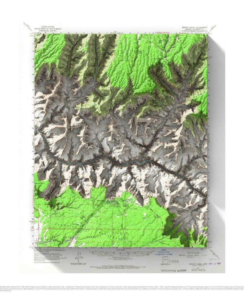
1962 USGS 1:62,500 topographic map with shaded relief in 20″ x 24″ layout. There was an extreme heat advisory when Andrea and I visited the Grand Canyon. Being youngish and in relatively good shape, we decided to hike down the Kaibab Trail and back up Bright Angel Trail as a day hike. It was reportedly […]
Rising Sun, Wisconsin

1983 USGS 1:24,000 topographic map with shaded relief in 24″ x 36″ layout.
Viroqua, Wisconsin
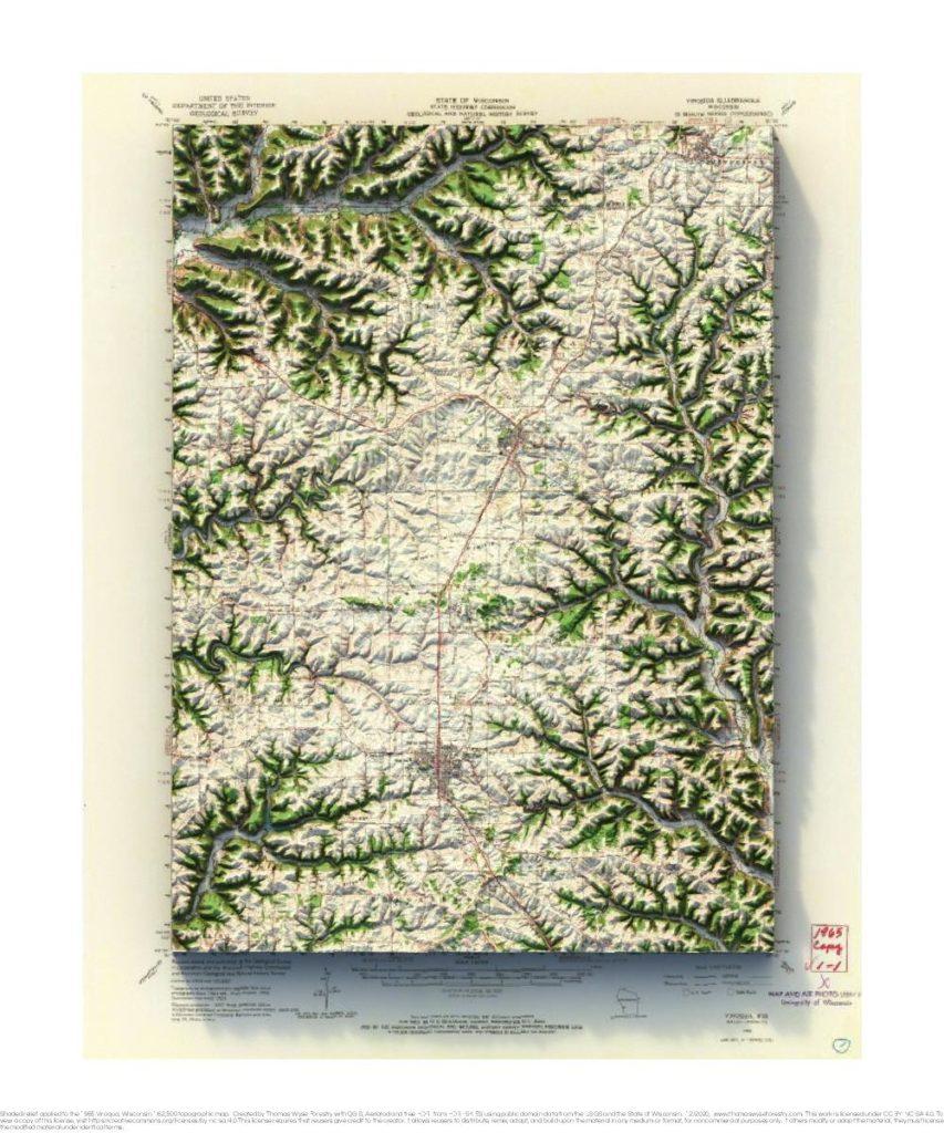
1965 USGS 1:62,500 topographic map with shaded relief in 20″ x 24″ layout.
Madison, Wisconsin
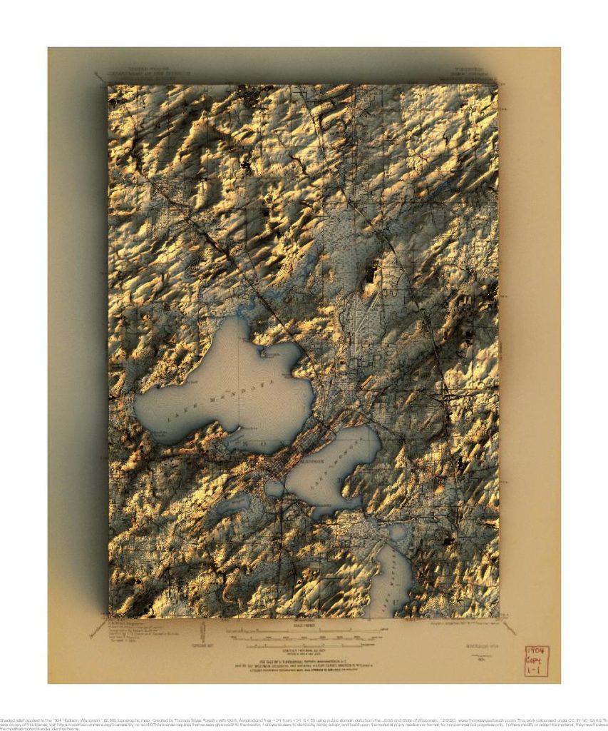
1904 USGS 1:62,500 topographic map with shaded relief in 20″ x 24″ layout. 1959 USGS 1:62,500 topographic map with shaded relief in 20″ x 24″ layout.