
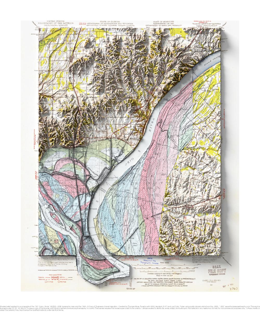
1931 USGS 1:62,500 topographic map with shaded relief in 20″ x 24″ layout.
This is part of a series of maps that show the major tributaries of the Mississippi River. This map shows the confluence of the Ohio River, and it includes a portion of the 1944 Fisk map of river meanders over time. This is very near the upstream end of the Fisk map. Cairo looks to be in a perilous location!