Covington, Kentucky
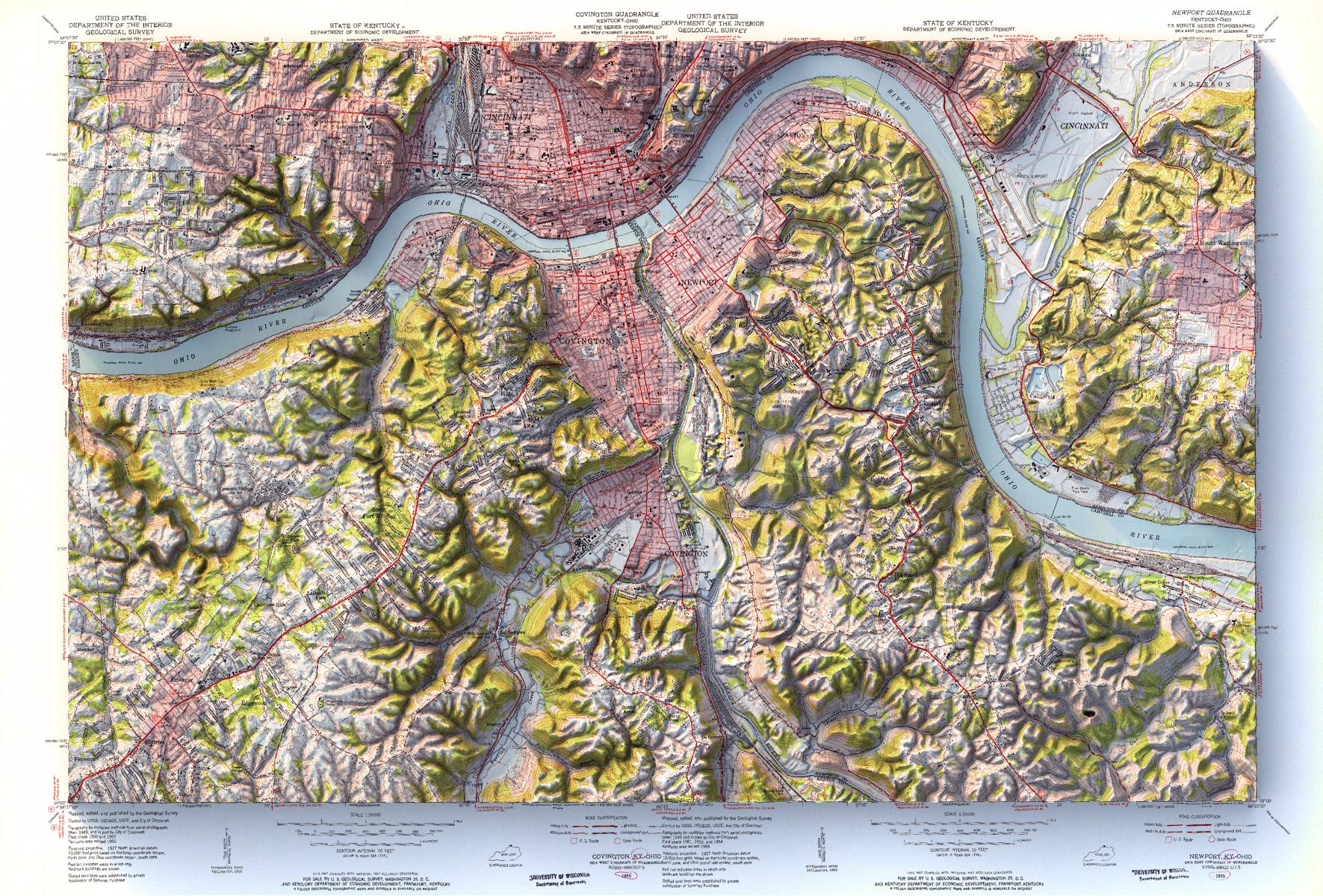
Mosaic of 1955 USGS Covington and Newport Kentucky topographic maps with shaded relief in 24″ x 36″ layout.

Mosaic of 1955 USGS Covington and Newport Kentucky topographic maps with shaded relief in 24″ x 36″ layout.

1897 USGS Portland, Oregon topographic map with shaded relief in 20″x30″ layout.

1958 (Revised 1965) 1:250,000 USGS Seattle, Washington topographic map with shaded relief in 24″ x 36″ layout.
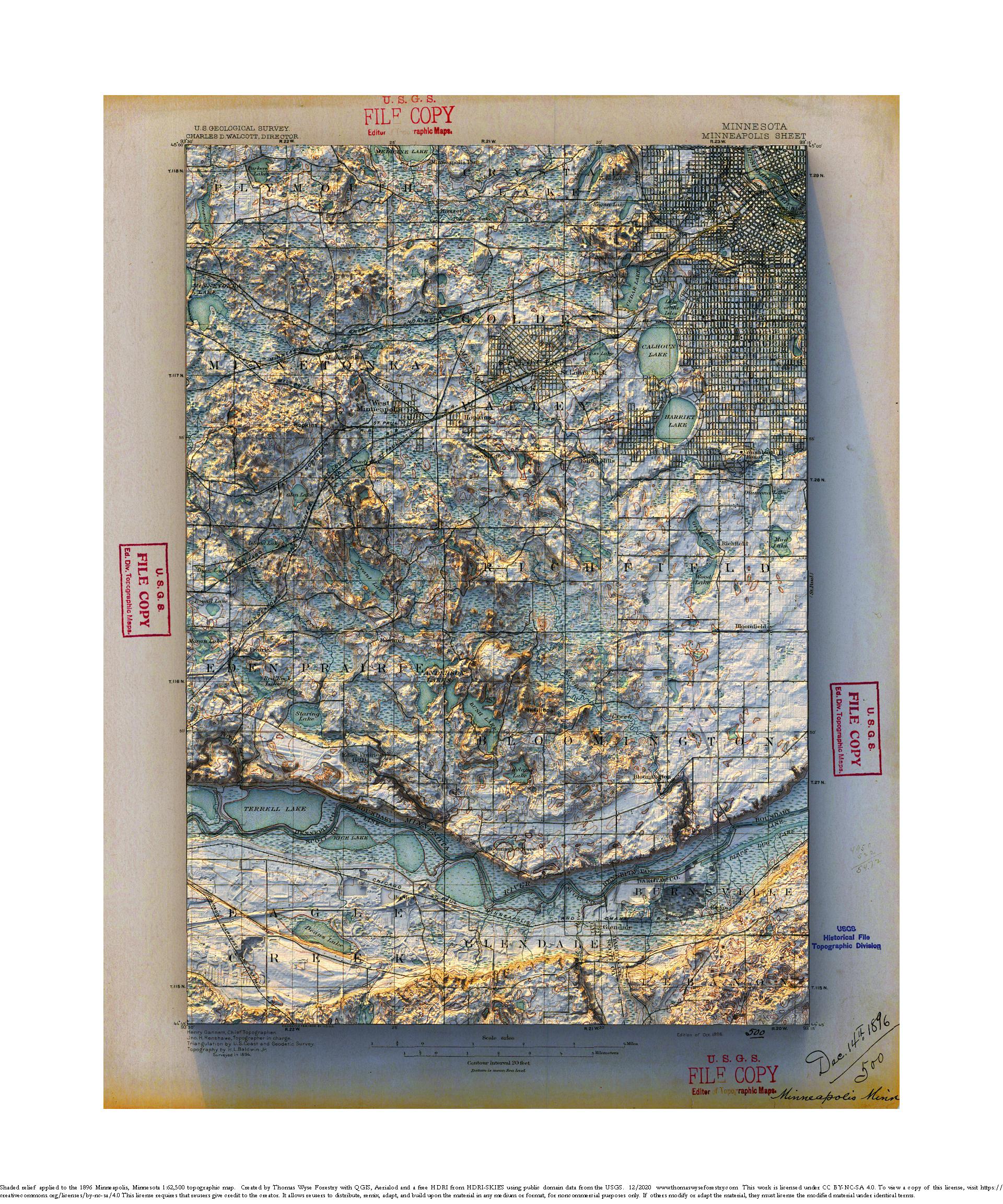
1896 1:62,500 USGS Minneapolis Sheet topographic map with shaded relief in 20″ x 24″ layout.
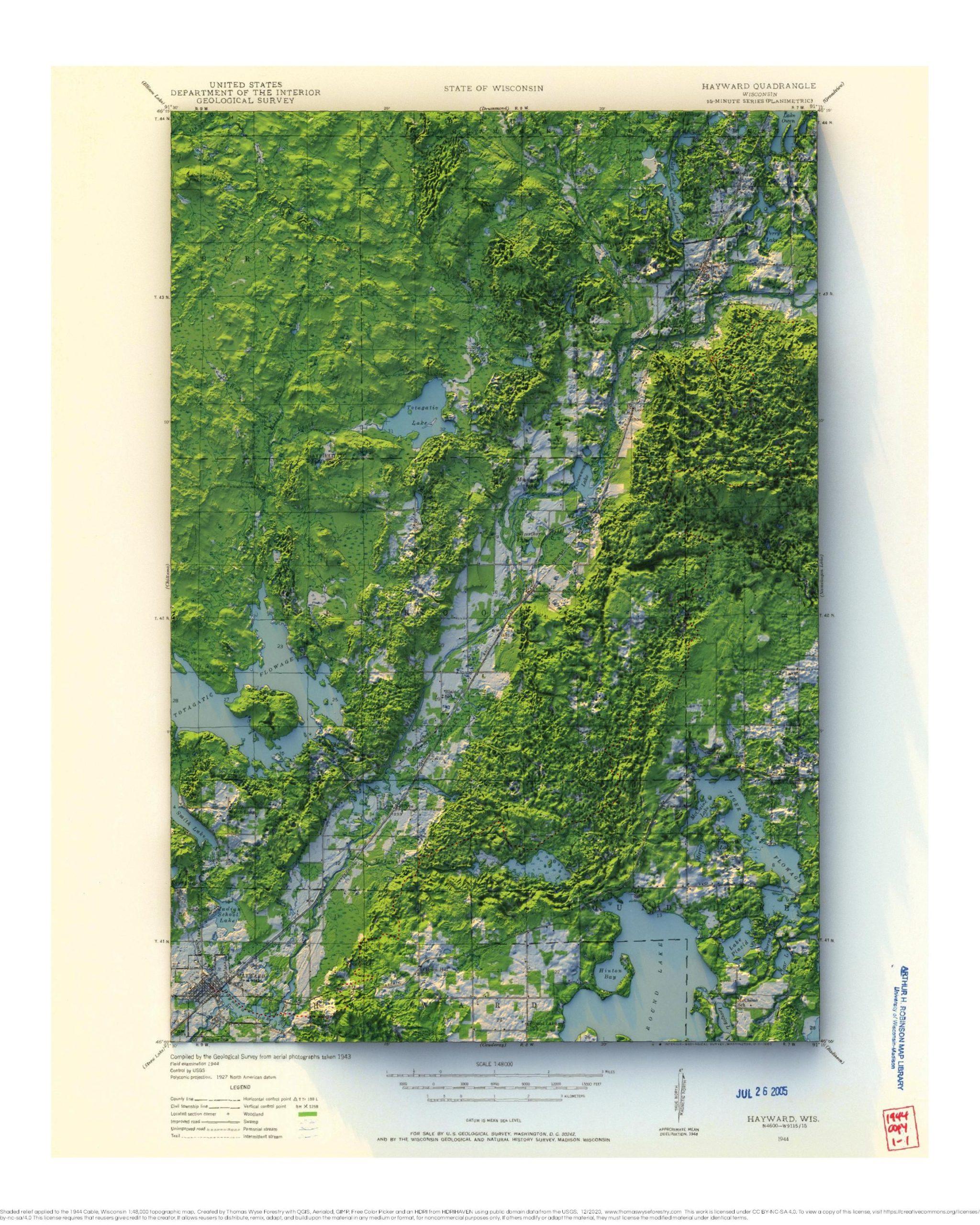
1944 1:48,000 USGS Cable topographic map with shaded relief in 20″ x 30″ layout with the location of the American Birkebeiner Trail show with a
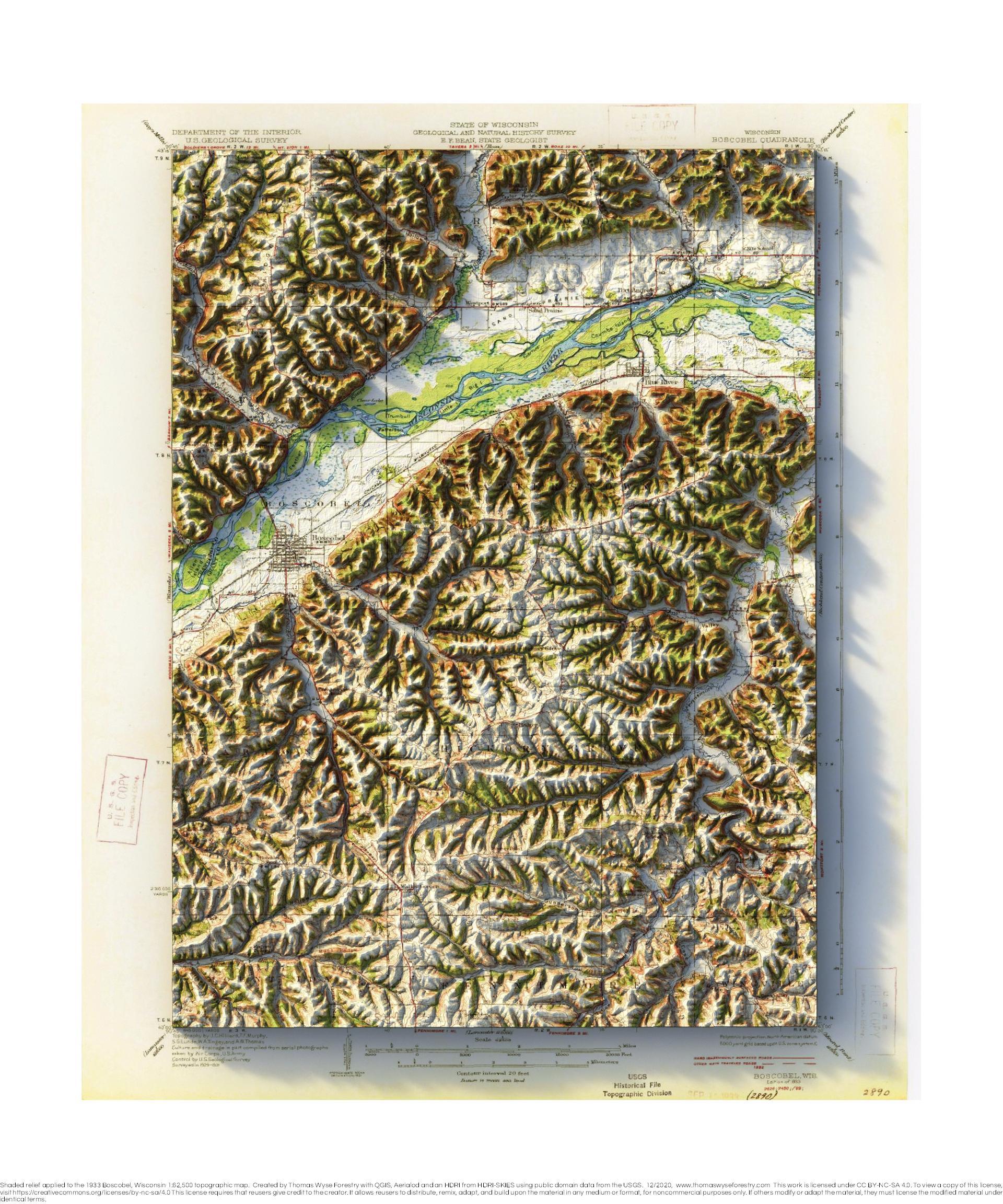
1933 1:62,500 USGS Boscobel topographic map with shaded relief in 20″ x 30″ layout
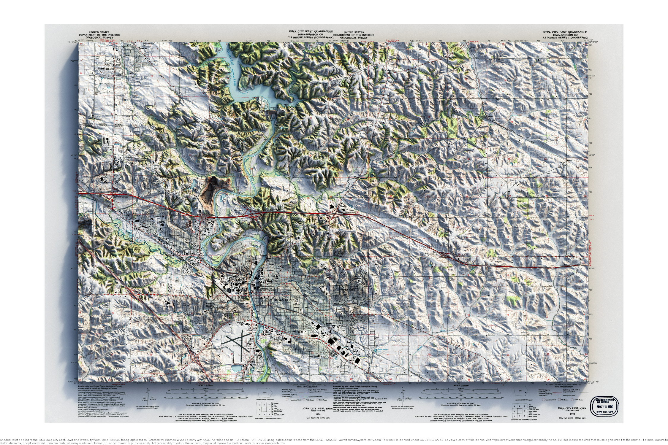
1993 1:24,000 USGS Iowa City topographic map mosaic with shaded relief in 20″ x 30″ layout

Mosaic of 1:100,000 1980s topographic maps with shaded relief in 24″x36″ layout This map is a mosaic of six 1:100,000 scale maps of the Lake
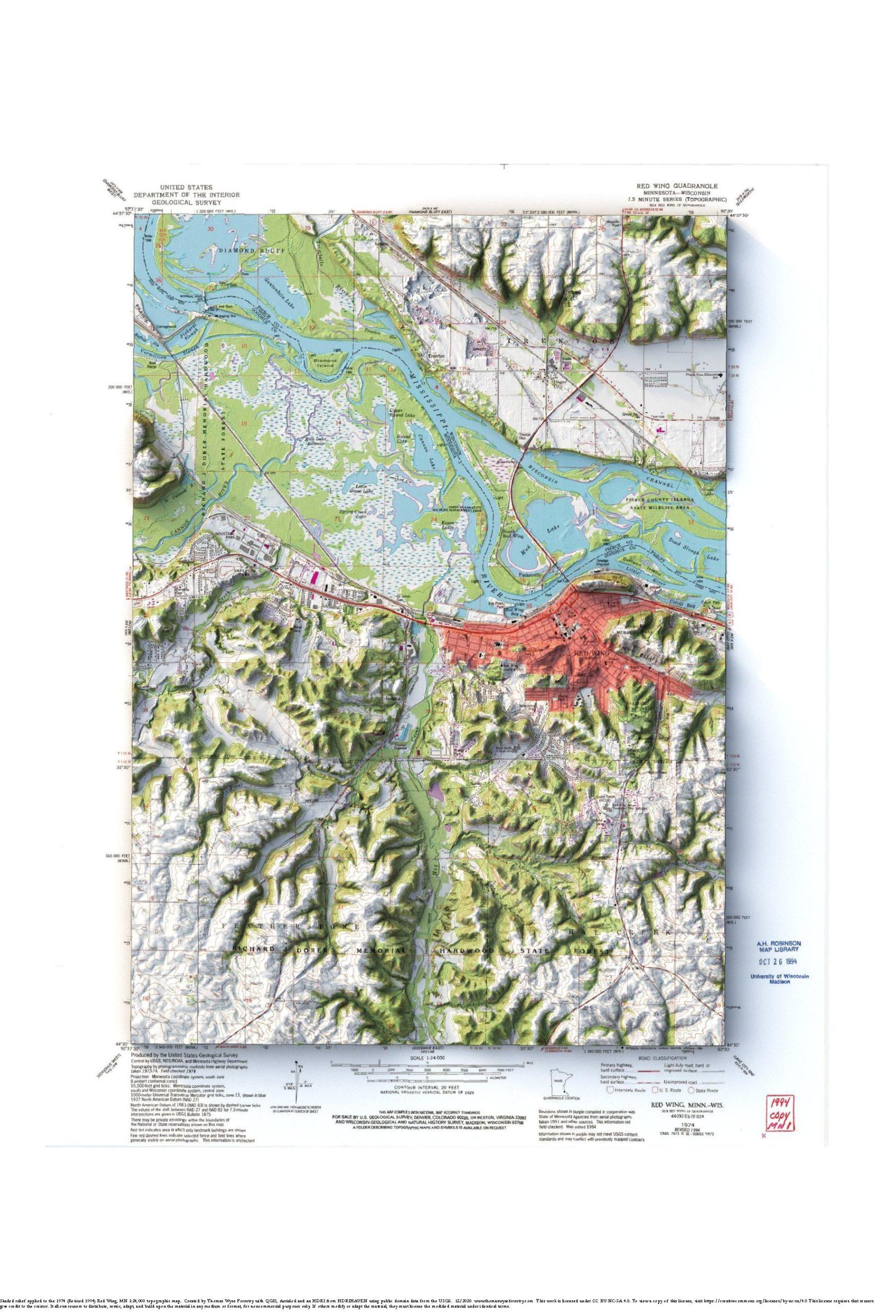
1974 1:24,000 USGS Red Wing topographic maps with shaded relief in 24″x36″ layout
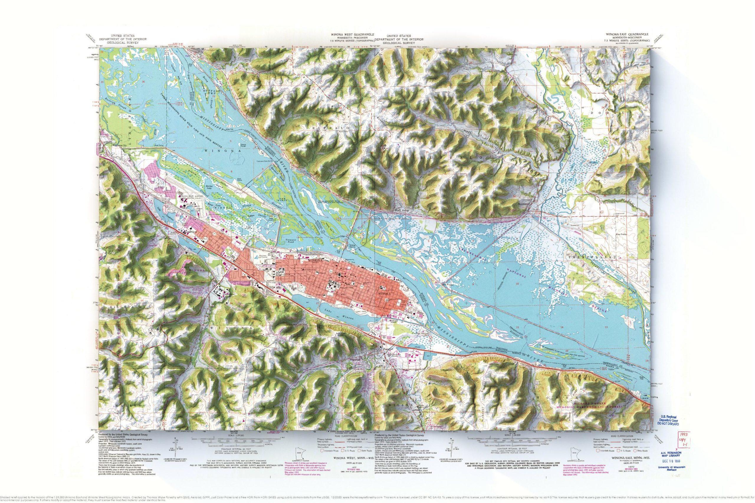
Mosaic of the1972 (Revised 1993) 1:24,000 USGS Winona East and Winona West topographic maps with shaded relief in 24″x36″ layout