
Lake Powell, Arizona and Utah
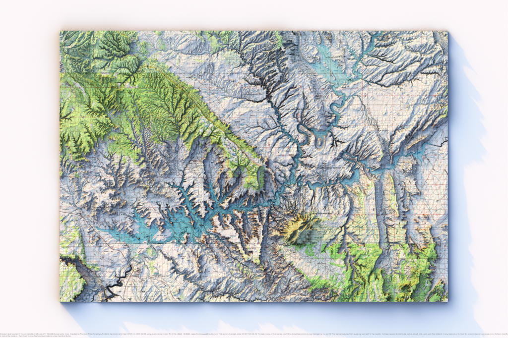
Mosaic of 1:100,000 1980s topographic maps with shaded relief in 24″x36″ layout This map is a mosaic of six 1:100,000 scale maps of the Lake Powell area. I didn’t try to color map the individual maps, but the map still looks nice.
Red Wing, Minnesota
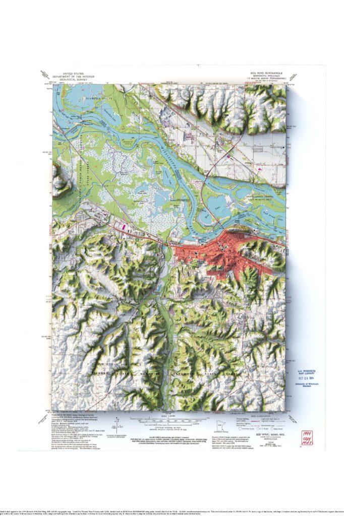
1974 1:24,000 USGS Red Wing topographic maps with shaded relief in 24″x36″ layout
Winona, Minnesota
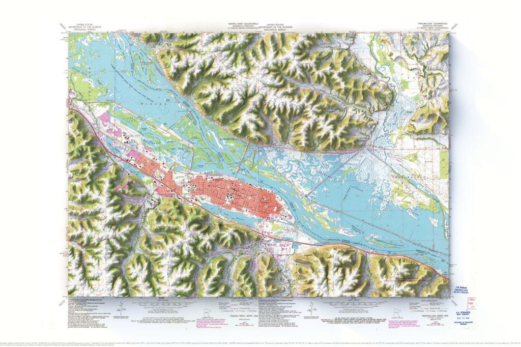
Mosaic of the1972 (Revised 1993) 1:24,000 USGS Winona East and Winona West topographic maps with shaded relief in 24″x36″ layout
Deer Yard Lake, Minnesota
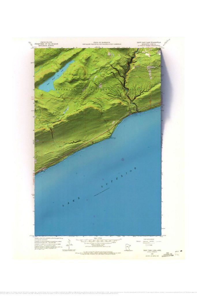
1958 1:24,000 USGS Deer Yard Lake topographic map with shaded relief in 24″x36″ layout This map is for my buddy Mike Lind who made this site for me. He and his wife have a cabin near the Cascade River. The bathymetry wasn’t very interesting, so I added a gradient to it to give it a […]
Mt. Rainier, Washington
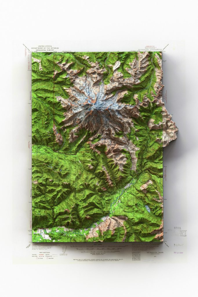
1924 1:125,000 USGS Mt. Rainier, Washington topographic map with shaded relief in 24″x36″ layout I made this map for my wife for Christmas. She loves Mt. Rainier. I really like maps that extend into the collar. It makes it more interesting. I used an HDRI that has two light directions for this map, and I […]
Wenatchee, Washington
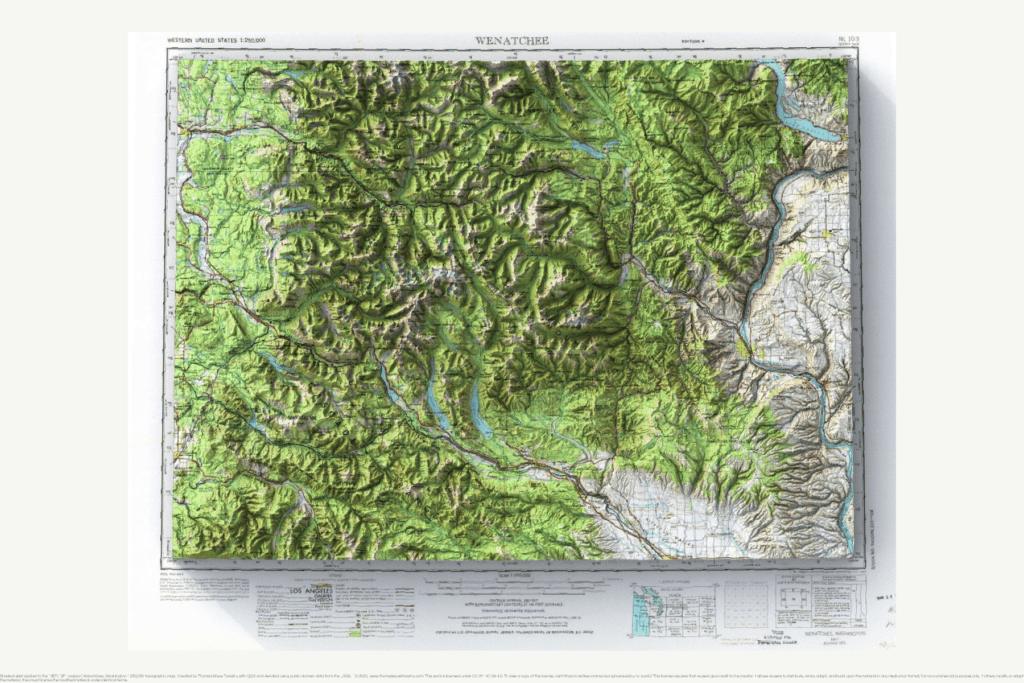
1983 1:250,000 USGS Wenatchee, Washington topographic map with shaded relief in 24″x36″ layout
Decorah, Iowa
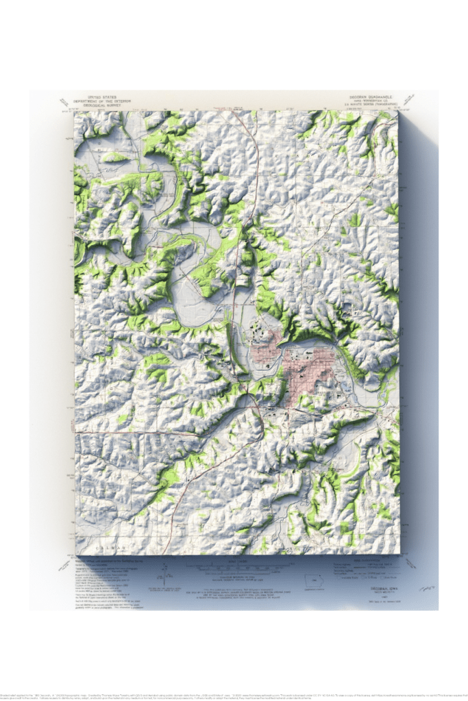
1983 1:24,000 USGS topographic map of Decorah, Iowa with shaded relief in 24″x36″ layout I grew up in Decorah, and I learned a lot when I made this map. The hill at Greentree Corners is the inside of an old meander. Luther College is on an abandoned meander that’s now been isolated by continued downcutting. […]