
L’Anse, Michigan
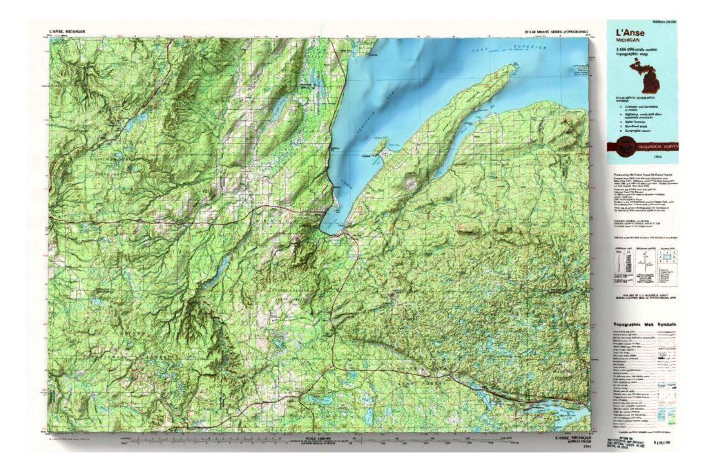
1991 USGS 1:100,000 topographic map with shaded relief in 24″ x 36″ layout. The scale in the layout is 1:109,200.
Ashland, Wisconsin
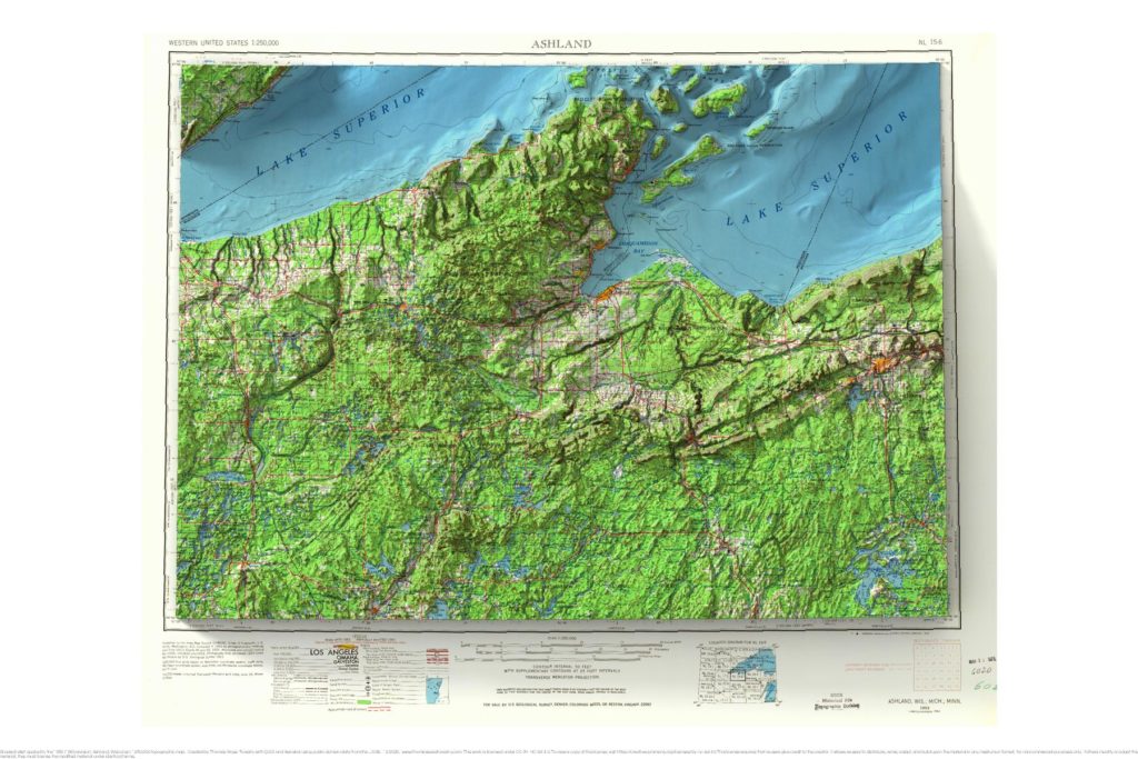
1953 USGS 1:250,000 topographic map with shaded relief in 24″ x 36″ layout.
Huron Mountain, Michigan
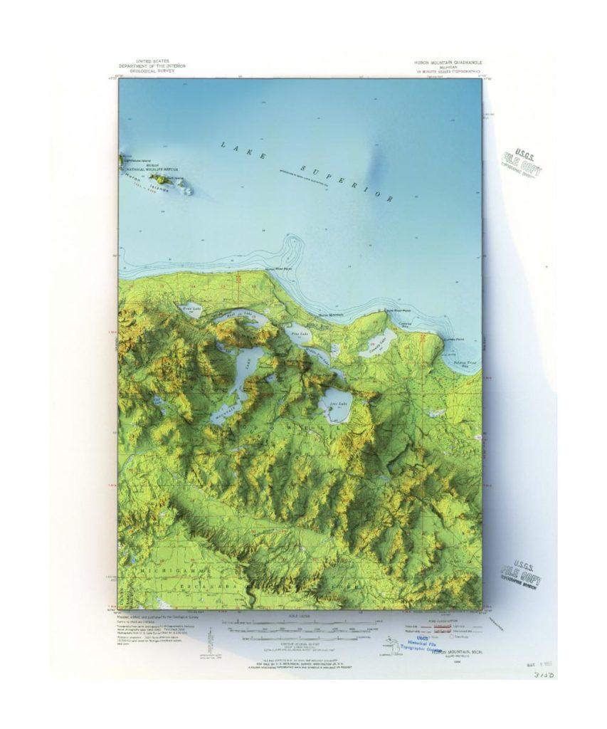
1954 USGS 1:62,500 Huron Mountain, Michigan topographic map with shaded relief in 20″ x 24″ layout.
Covington, Kentucky
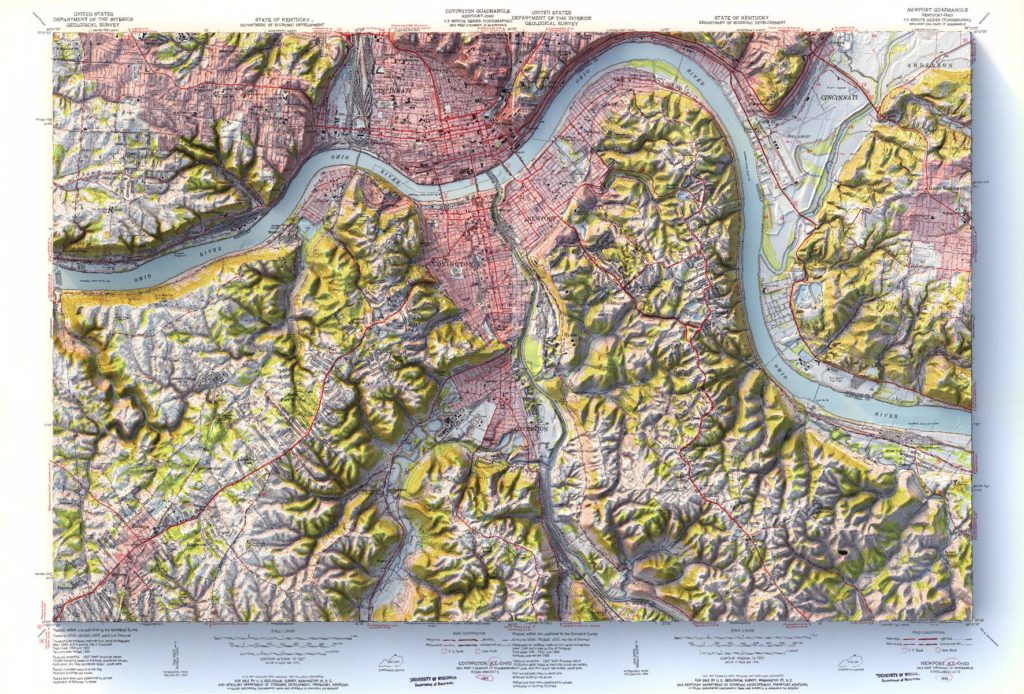
Mosaic of 1955 USGS Covington and Newport Kentucky topographic maps with shaded relief in 24″ x 36″ layout.
Portland, Oregon
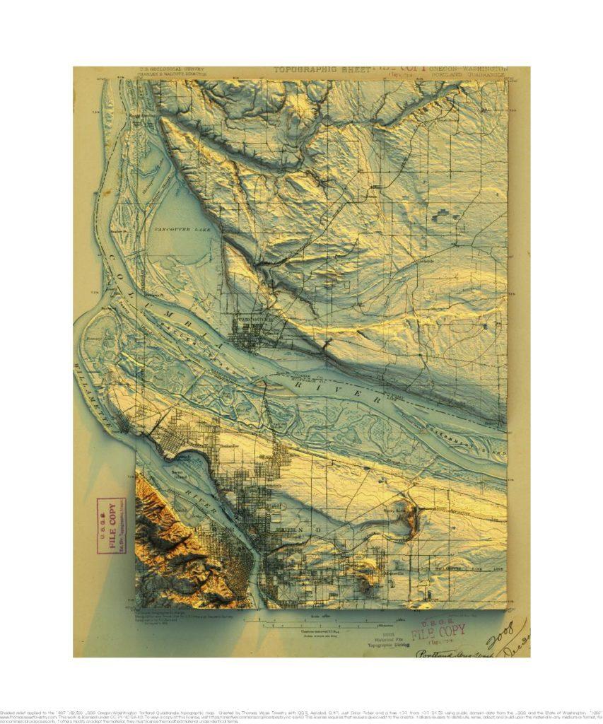
1897 USGS Portland, Oregon topographic map with shaded relief in 20″x30″ layout.
Seattle, Washington
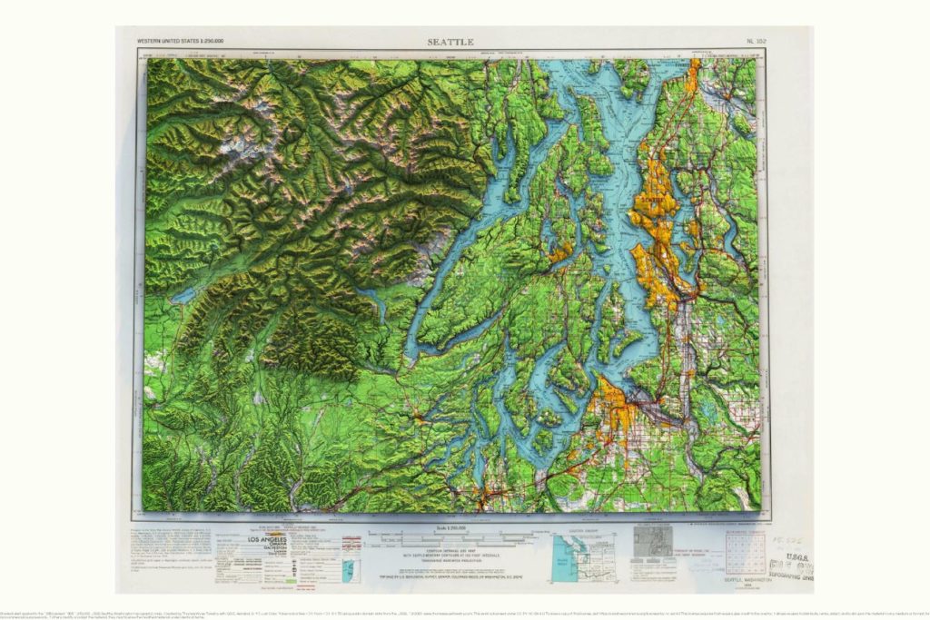
1958 (Revised 1965) 1:250,000 USGS Seattle, Washington topographic map with shaded relief in 24″ x 36″ layout.
Minneapolis, Minnesota
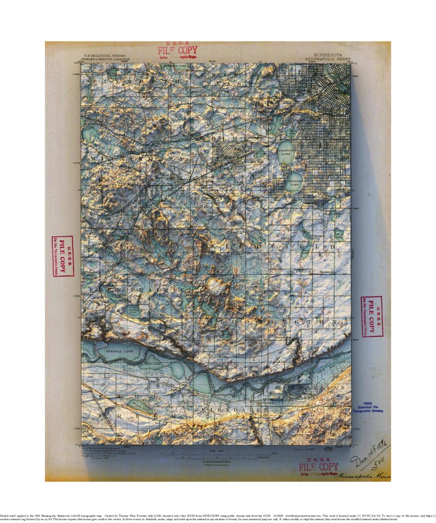
1896 1:62,500 USGS Minneapolis Sheet topographic map with shaded relief in 20″ x 24″ layout.
Cable, Wisconsin
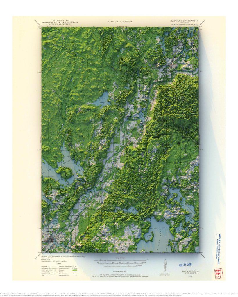
1944 1:48,000 USGS Cable topographic map with shaded relief in 20″ x 30″ layout with the location of the American Birkebeiner Trail show with a subtle red dashed line.
Boscobel, Wisconsin
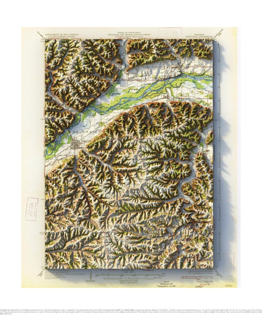
1933 1:62,500 USGS Boscobel topographic map with shaded relief in 20″ x 30″ layout
Iowa City, Iowa, East and West
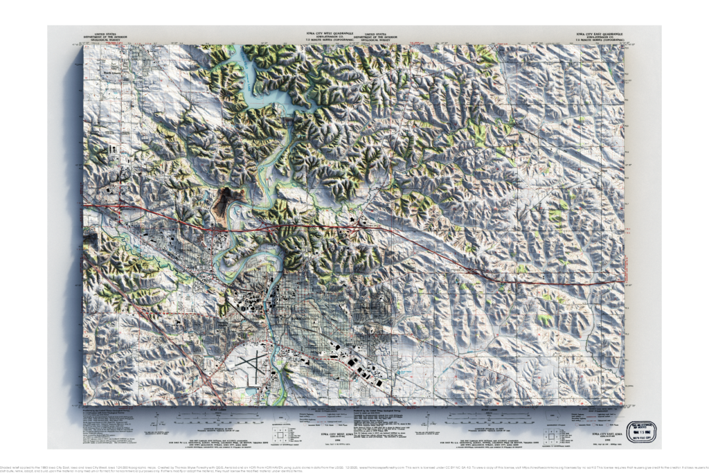
1993 1:24,000 USGS Iowa City topographic map mosaic with shaded relief in 20″ x 30″ layout