
Artonish, Louisiana
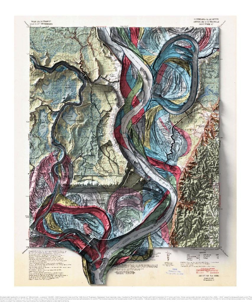
1939 USGS 1:62,500 topographic map with shaded relief in 20″ x 24″ layout. This is part of a series of maps that show the major tributaries and distributaries of the Mississippi River. This map was made prior when the Lower Old River was closed and a controlled outflow channel was created in 1963. The controlled […]
Memphis, Tennessee
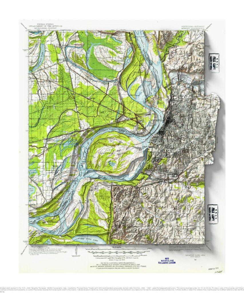
1913 USGS 1:62,500 topographic map with shaded relief in 20″ x 24″ layout. I don’t have a special connection to Memphis, but I remember a line from a Chris Smither song about Memphis being “high up on a bluff”. I took a look, and sure enough, it is up on a bluff above the Mississippi. […]
Bright Angel, Arizona
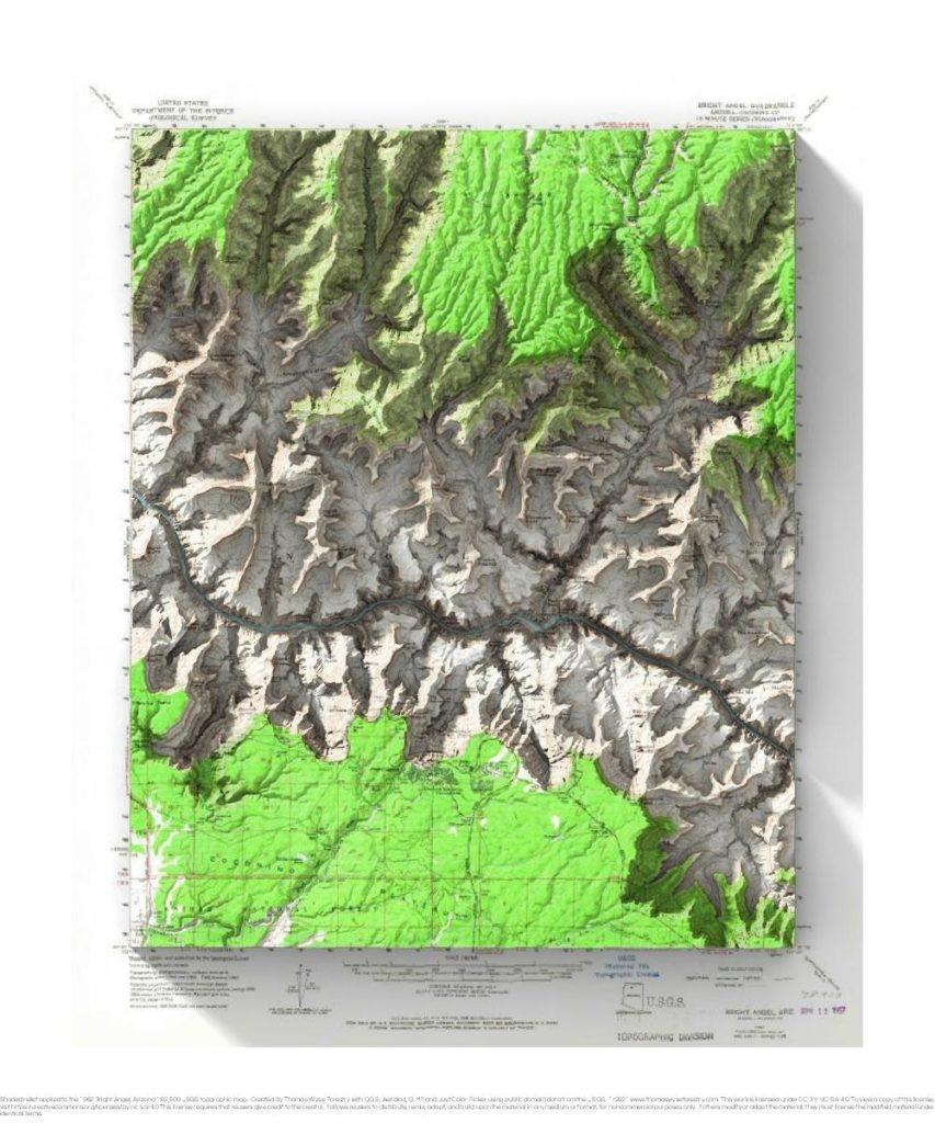
1962 USGS 1:62,500 topographic map with shaded relief in 20″ x 24″ layout. There was an extreme heat advisory when Andrea and I visited the Grand Canyon. Being youngish and in relatively good shape, we decided to hike down the Kaibab Trail and back up Bright Angel Trail as a day hike. It was reportedly […]
Rising Sun, Wisconsin
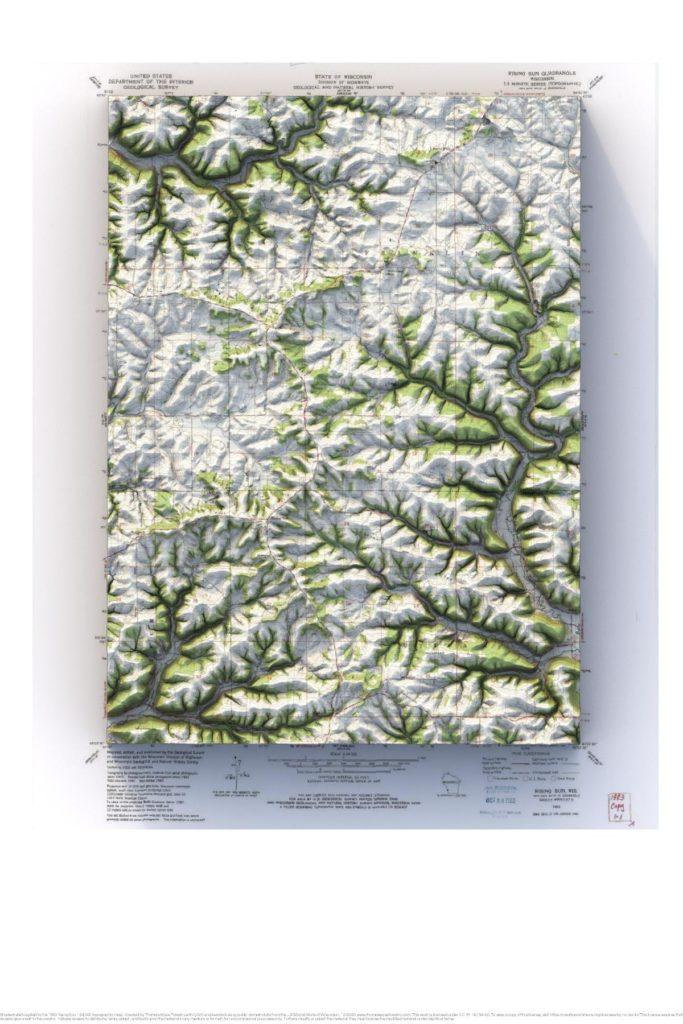
1983 USGS 1:24,000 topographic map with shaded relief in 24″ x 36″ layout.
Viroqua, Wisconsin
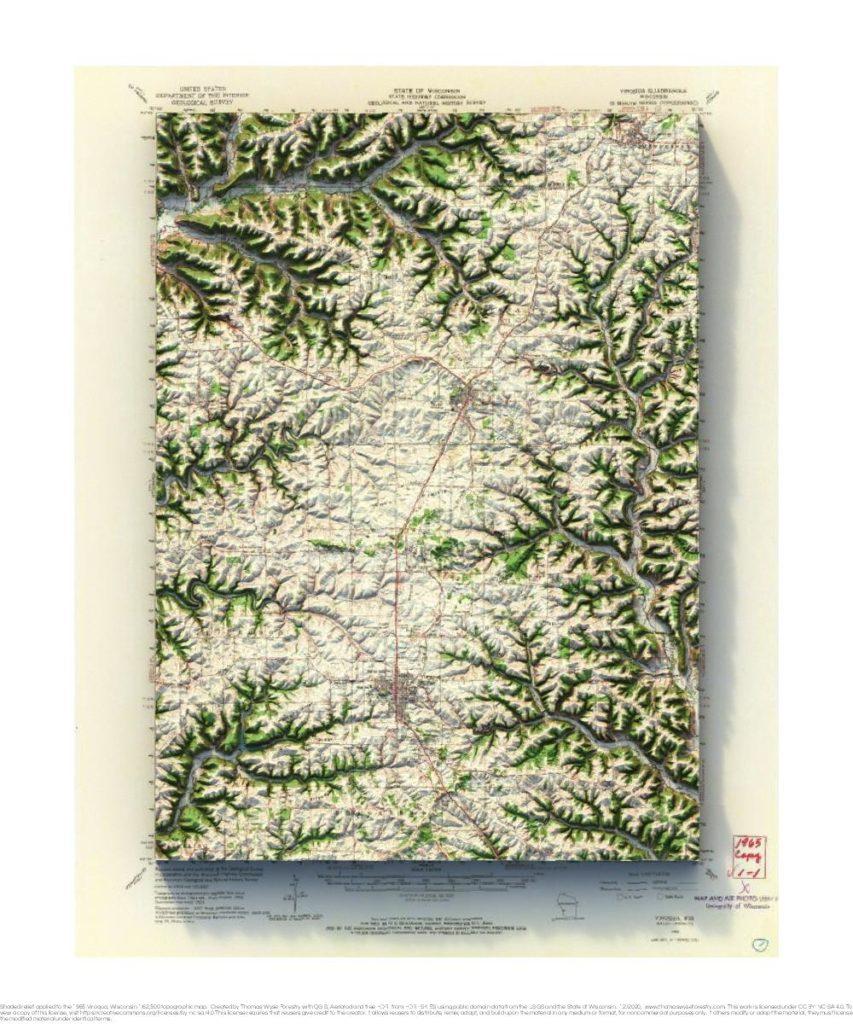
1965 USGS 1:62,500 topographic map with shaded relief in 20″ x 24″ layout.
Madison, Wisconsin
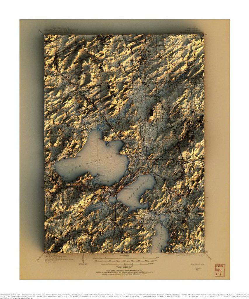
1904 USGS 1:62,500 topographic map with shaded relief in 20″ x 24″ layout. 1959 USGS 1:62,500 topographic map with shaded relief in 20″ x 24″ layout.
L’Anse, Michigan
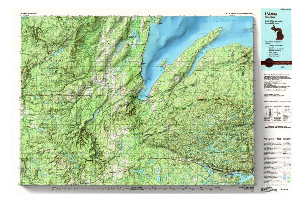
1991 USGS 1:100,000 topographic map with shaded relief in 24″ x 36″ layout. The scale in the layout is 1:109,200.
Ashland, Wisconsin
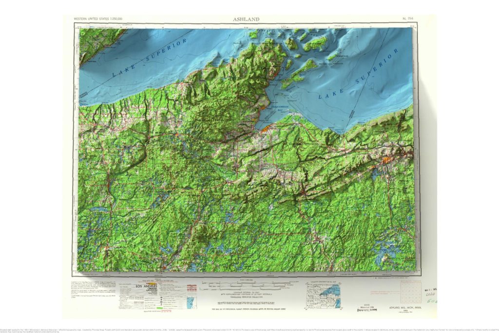
1953 USGS 1:250,000 topographic map with shaded relief in 24″ x 36″ layout.
Huron Mountain, Michigan
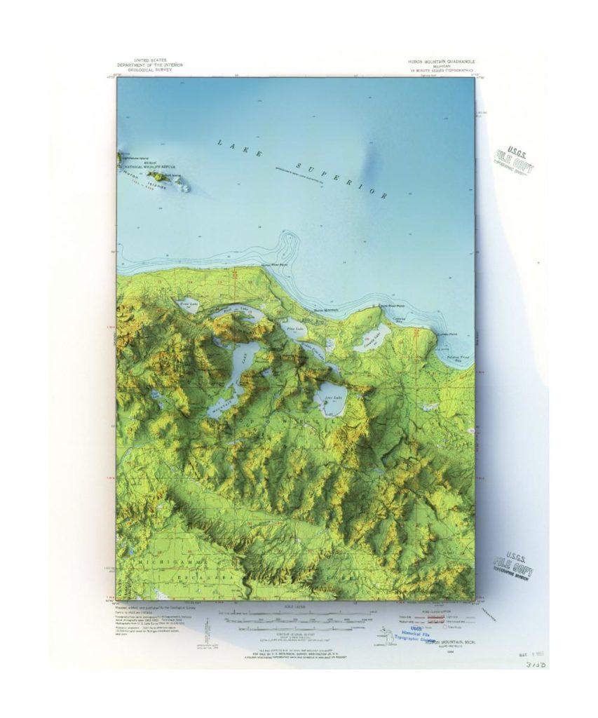
1954 USGS 1:62,500 Huron Mountain, Michigan topographic map with shaded relief in 20″ x 24″ layout.
Covington, Kentucky
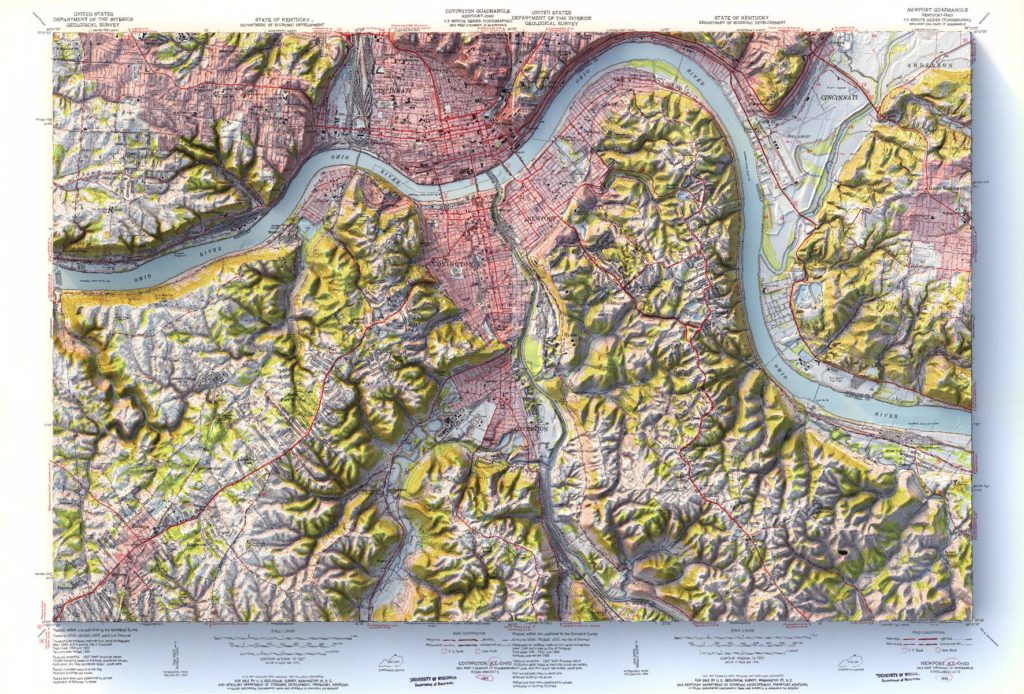
Mosaic of 1955 USGS Covington and Newport Kentucky topographic maps with shaded relief in 24″ x 36″ layout.