
Fountain, Minnesota
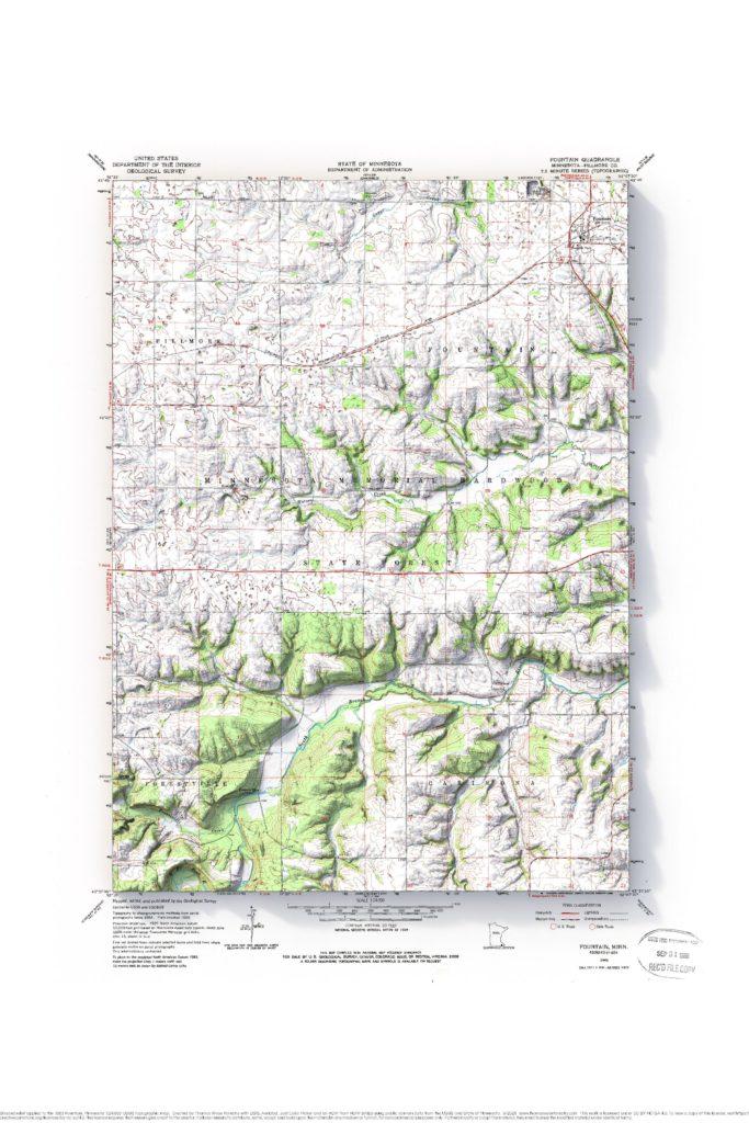
1963 Fountain, Minnesota 1:24,000 USGS topographic map with shaded relief.
Mt. Sterling, Wisconsin
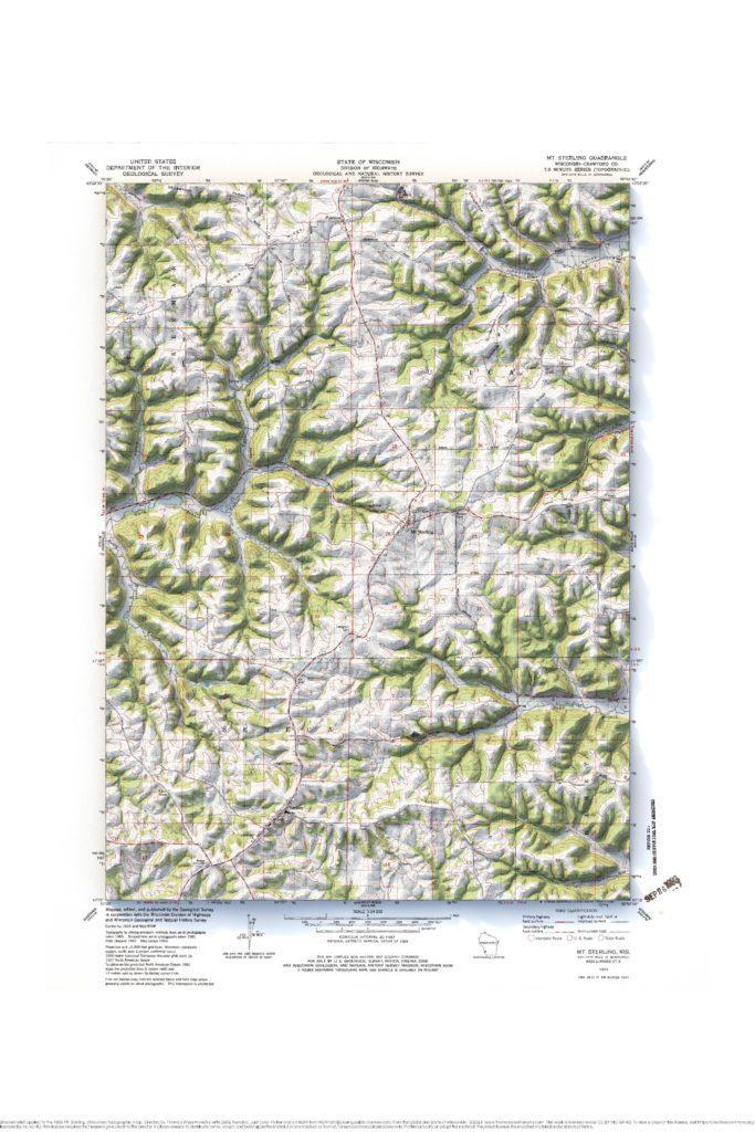
1983 Mt. Sterling, Wisconsin 1:24,000 USGS topographic map with shaded relief.
Washburn, Wisconsin
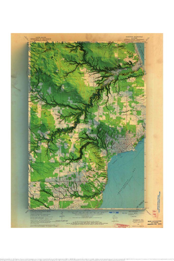
1964 Washburn, Wisconsin 1:24,000 USGS topographic map with shaded relief. I made a mistake clipping the elevation information, and I didn’t realize it until I overlaid the map on the shading. I actually kind of like the extra collar of elevation. I really like how yellowed and stained this map is. I also think that […]
Richland Center, Wisconsin
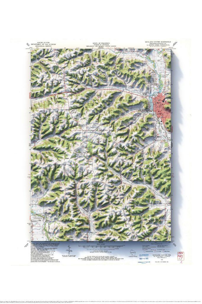
1983 Richland Center 1:24,000 USGS topographic map with shaded relief
Galesville, Wisconsin
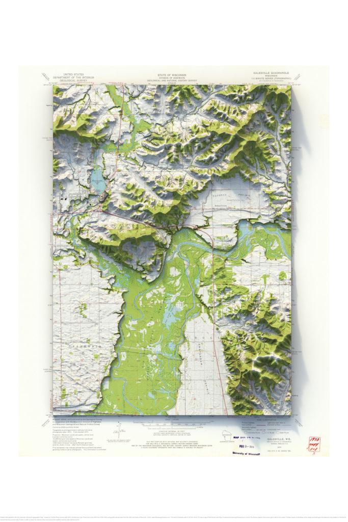
1973 Galesville 1:24,000 USGS topographic map with shaded relief
Grangeville, Idaho
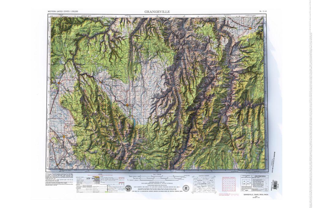
1955 (revised 1979) Grangeville, Idaho, Oregon and Washington 1:250,000 USGS topographic map with shaded relief
Avoca, Wisconsin
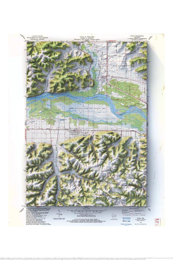
1983 Avoca, Wisconsin 1:24,000 USGS topographic map with shaded relief
Mellen and the Bad River, Wisconsin
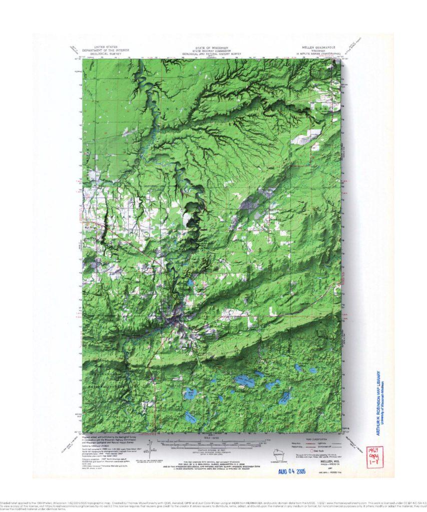
1967 Mellen, Wisconsin 1:62,500 USGS topographic map with shaded relief Here are a couple of relative elevation model maps of the Bad River.
Tomah, Wisconsin
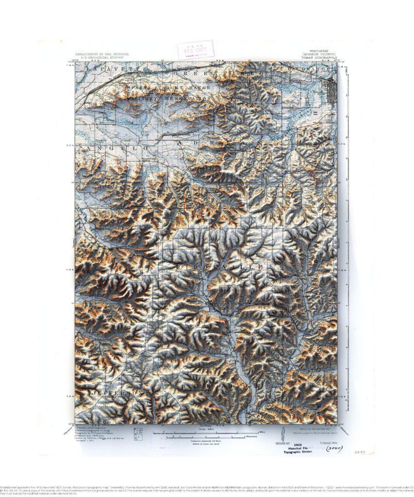
Tomah 1916 (reprinted 1927), Wisconsin 1:62,500 USGS topographic map with shaded relief
Gillingham, Wisconsin
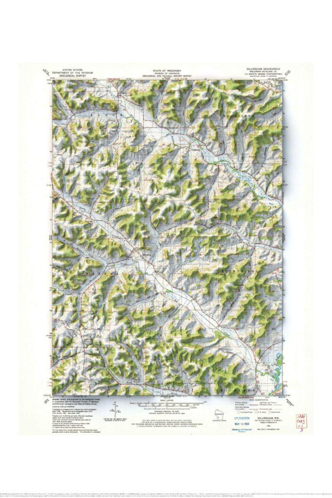
1983 Gillingham, Wisconsin USGS topographic map with shaded relief