
Grangeville, Idaho
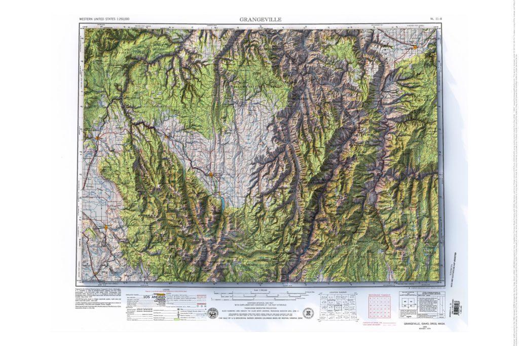
1955 (revised 1979) Grangeville, Idaho, Oregon and Washington 1:250,000 USGS topographic map with shaded relief
Avoca, Wisconsin
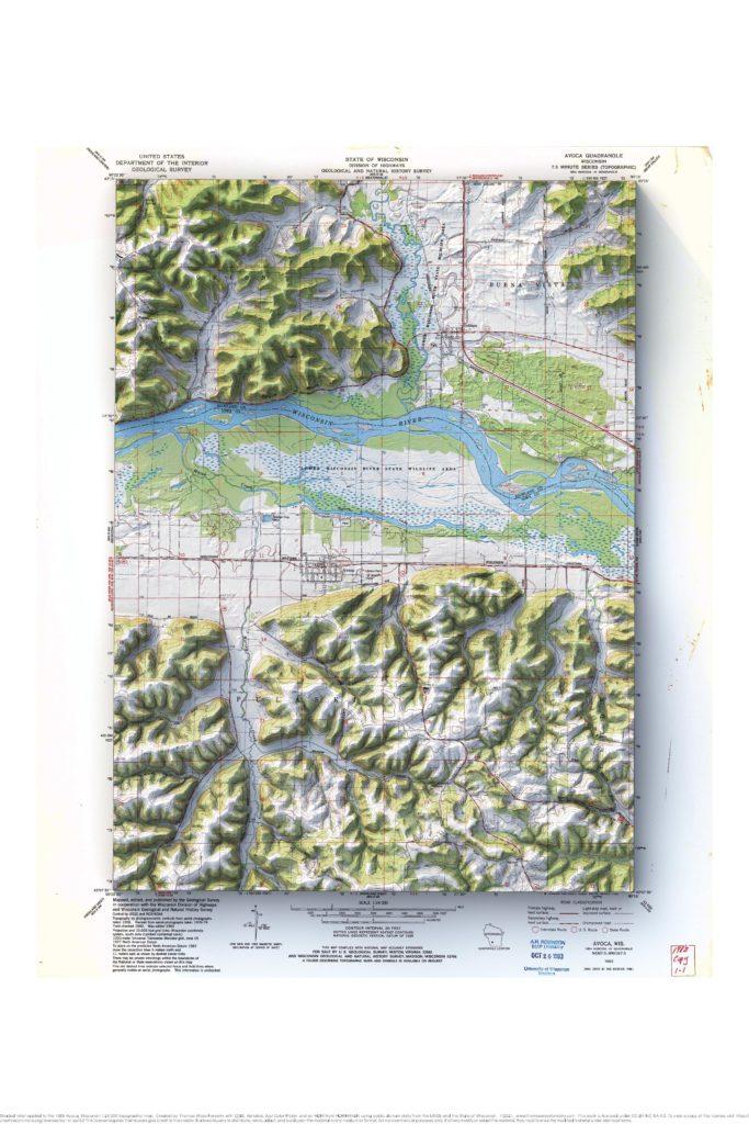
1983 Avoca, Wisconsin 1:24,000 USGS topographic map with shaded relief
Mellen and the Bad River, Wisconsin
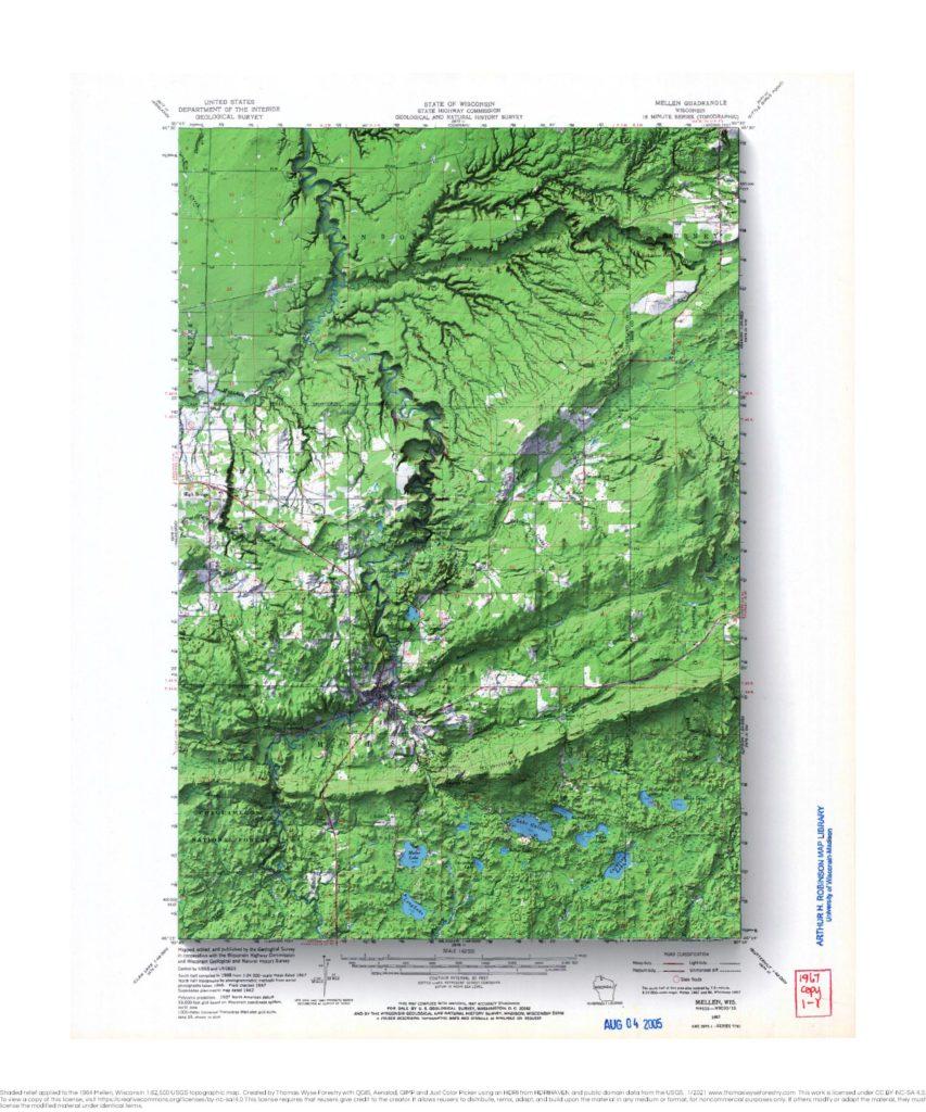
1967 Mellen, Wisconsin 1:62,500 USGS topographic map with shaded relief Here are a couple of relative elevation model maps of the Bad River.
Tomah, Wisconsin
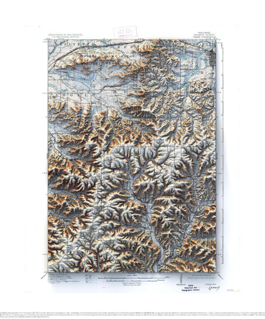
Tomah 1916 (reprinted 1927), Wisconsin 1:62,500 USGS topographic map with shaded relief
Gillingham, Wisconsin
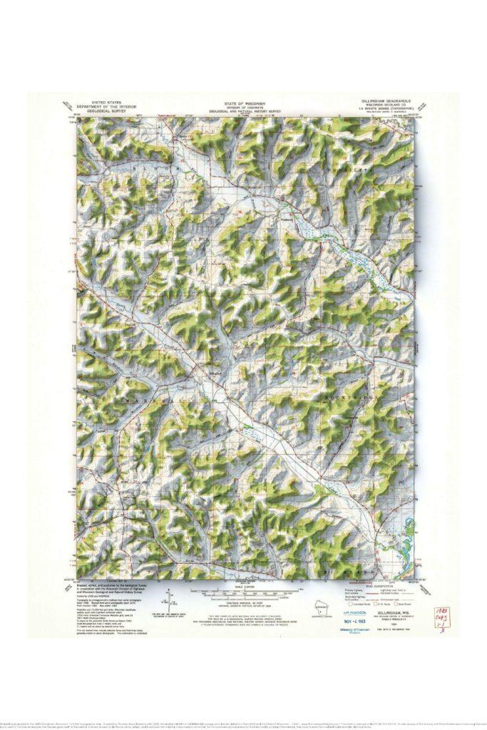
1983 Gillingham, Wisconsin USGS topographic map with shaded relief
Glacier National Park, Montana
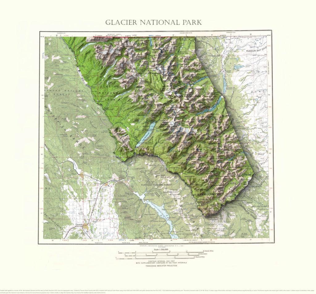
A mosaic of the 1961 Kalispell, Montana and the 1960 Cut Bank Montana 1:250,000 USGS topographic maps with shaded relief highlighting Glacier National Park.
St. Charles, Iowa
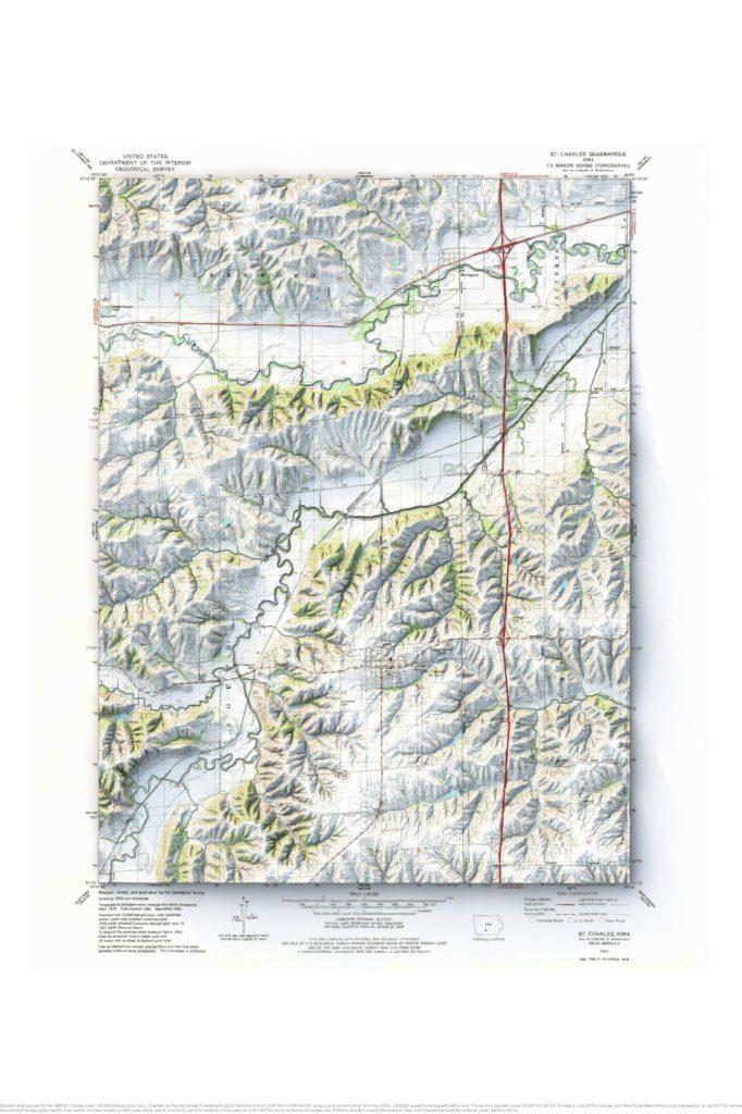
1983 St. Charles, Iowa 1:24,000 map with shaded relief.
Prairie du Chien and Bridgeport, Wisconsin mosaic
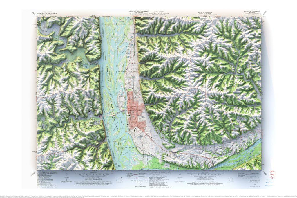
1983 Prairie du Chien, Iowa-Wisconsin and Bridgeport, Wisconsin 1:24,000 map mosaic with shaded relief.
La Crosse, Wisconsin and La Crescent, Minnesota mosaic
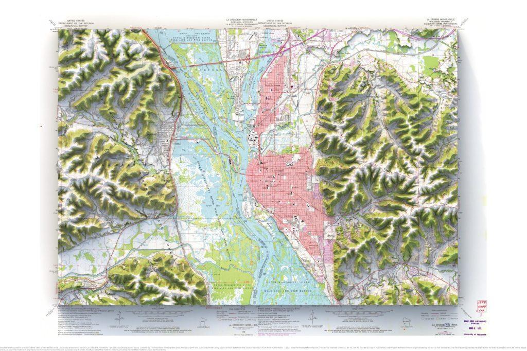
1963 (photorevised 1973) La Crosse and 1973 La Crescent 1:24,000 map with shaded relief.
Indianville, Michigan
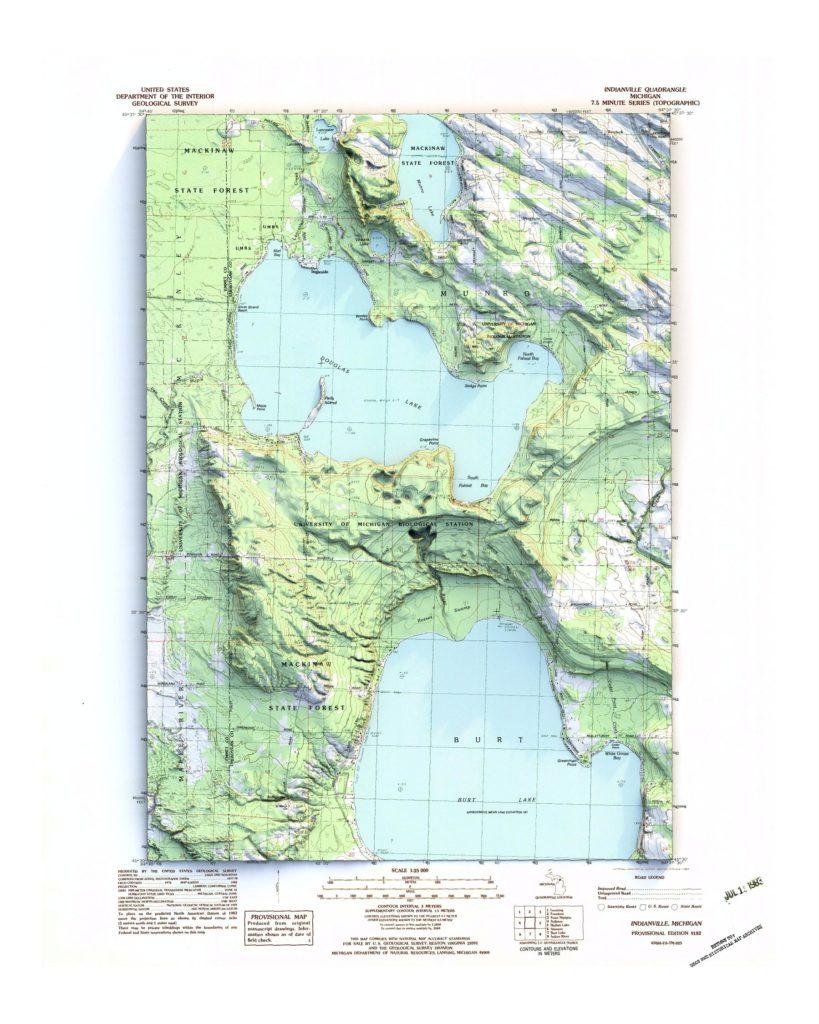
1982 1:25,000 map with shaded relief.