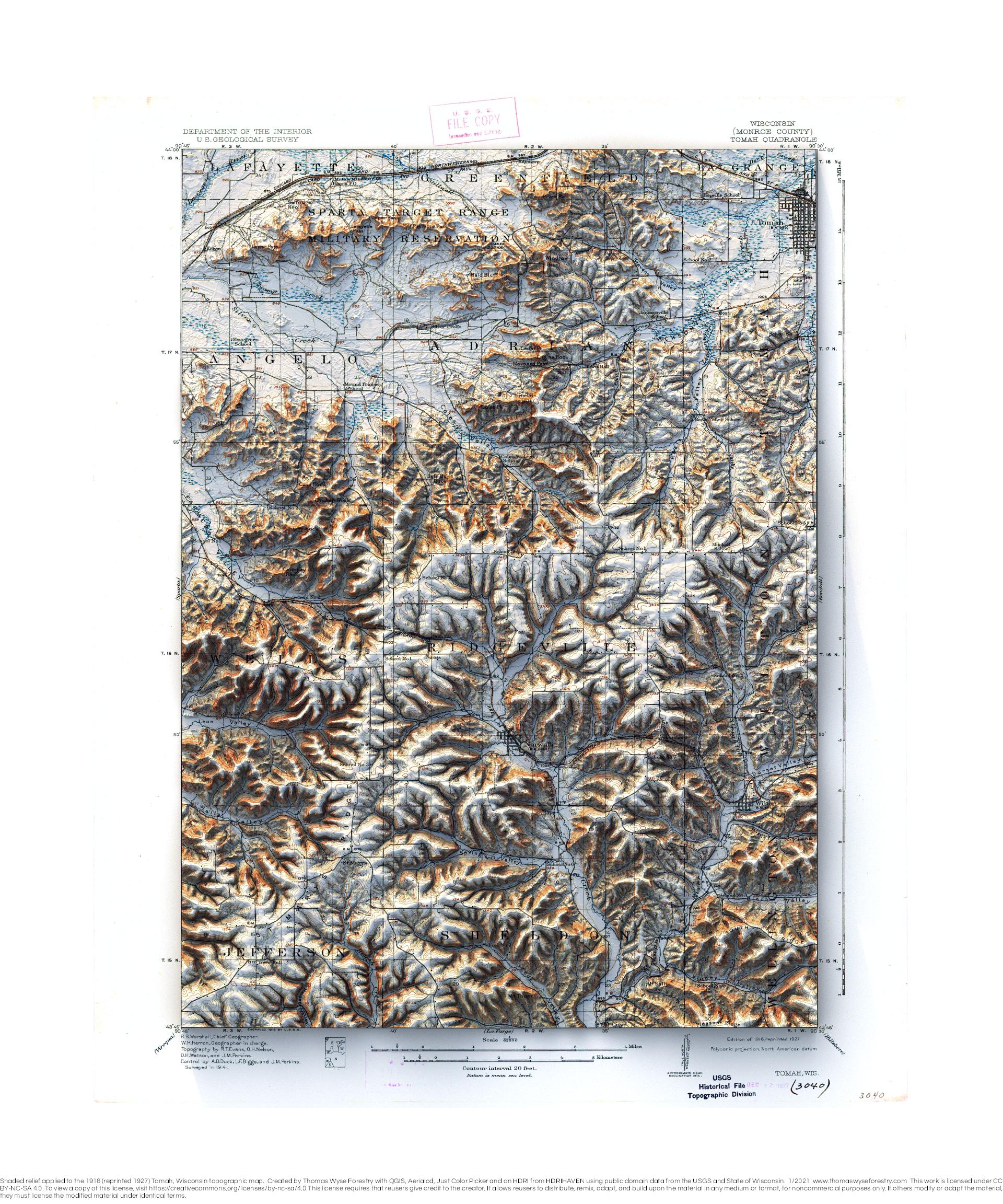
Tomah, Wisconsin
Tomah 1916 (reprinted 1927), Wisconsin 1:62,500 USGS topographic map with shaded relief

Tomah 1916 (reprinted 1927), Wisconsin 1:62,500 USGS topographic map with shaded relief
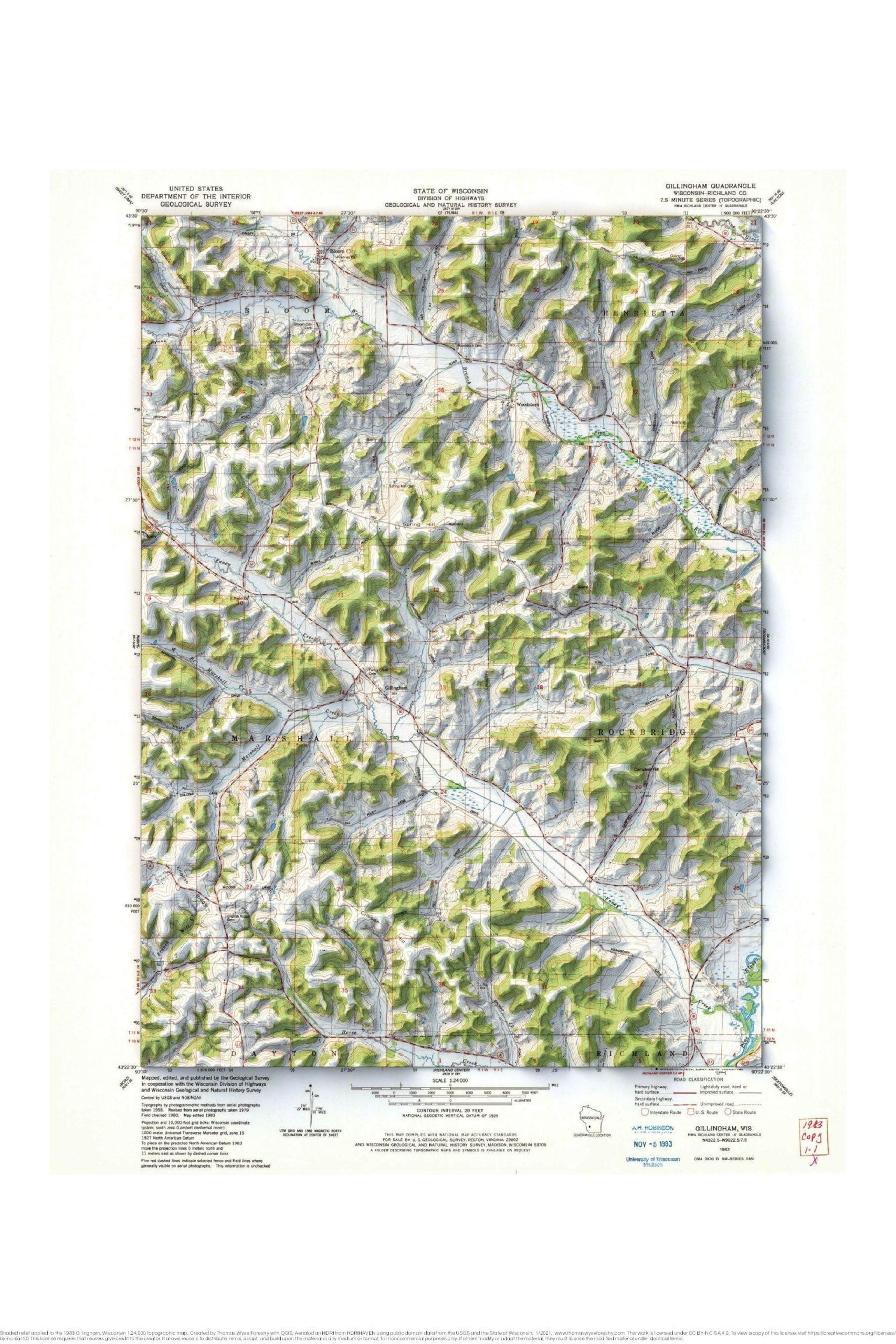
1983 Gillingham, Wisconsin USGS topographic map with shaded relief

1983 Prairie du Chien, Iowa-Wisconsin and Bridgeport, Wisconsin 1:24,000 map mosaic with shaded relief.
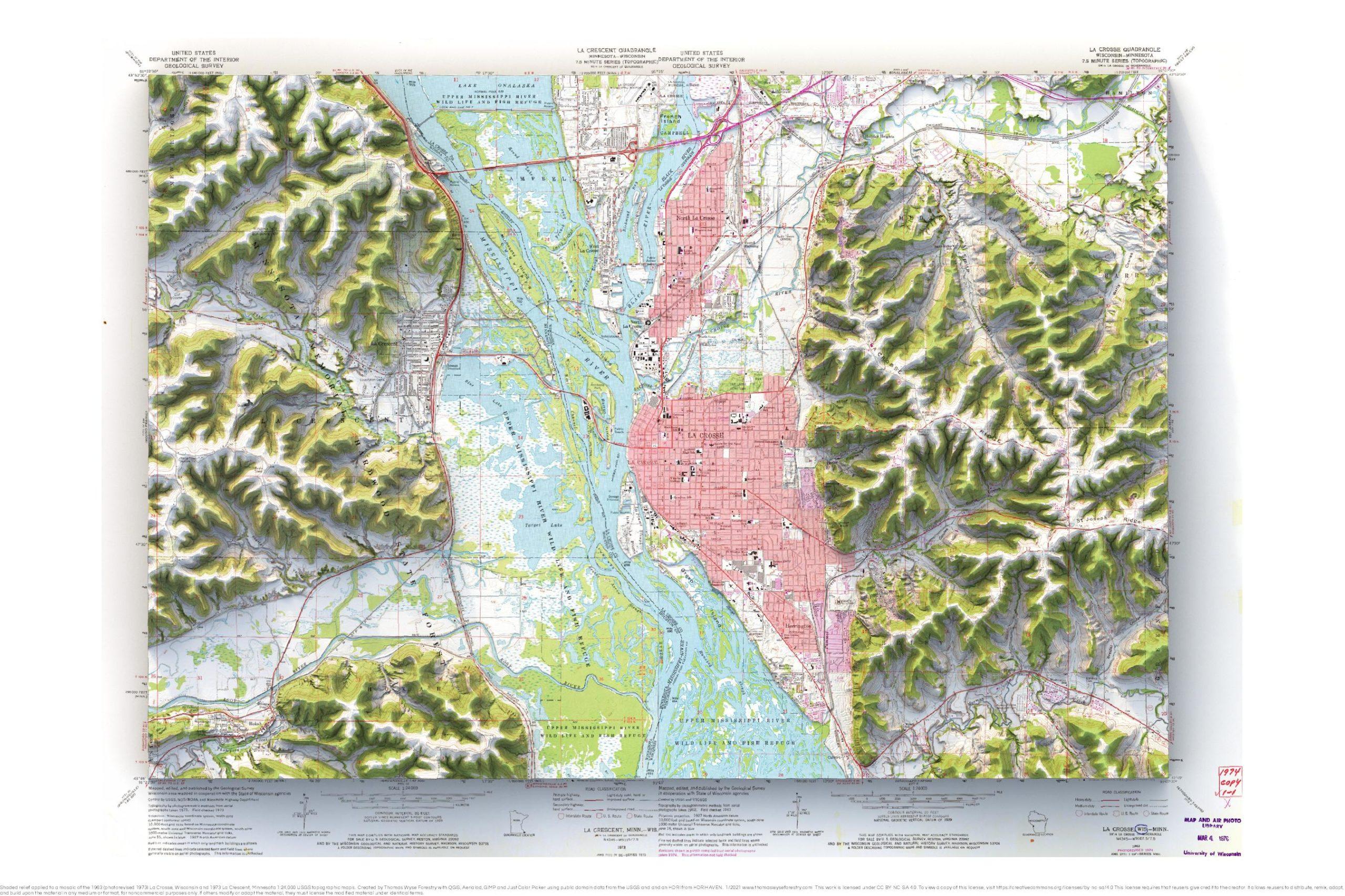
1963 (photorevised 1973) La Crosse and 1973 La Crescent 1:24,000 map with shaded relief.
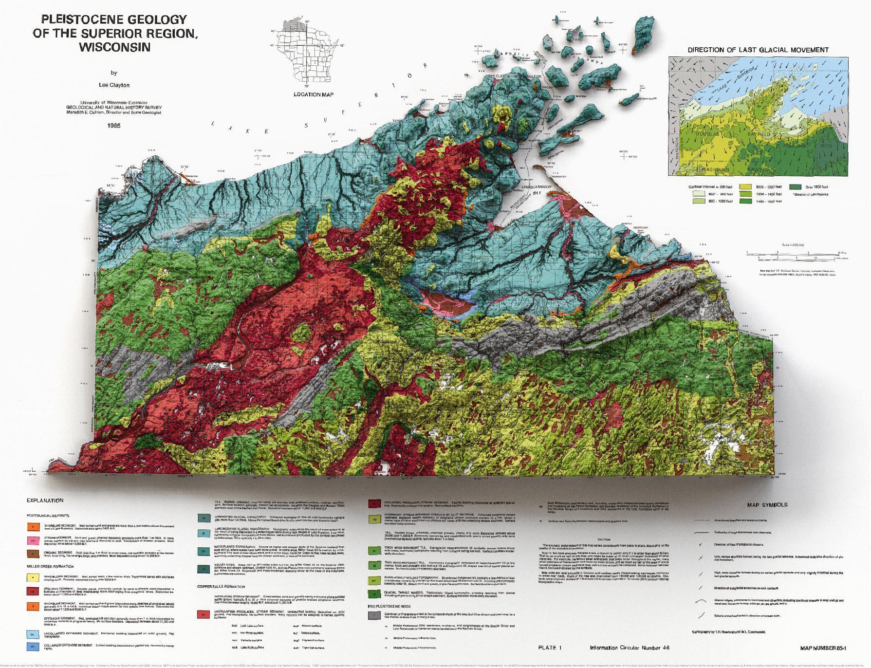
1985 1:250,000 map with shaded relief. This is one of my favorite maps. It was vexingly difficult to show the topography and still allow the map to be readable. It’s more instructive to look at the elevation separately from the map, but then you lose out on the bold colors of the map. Alas.
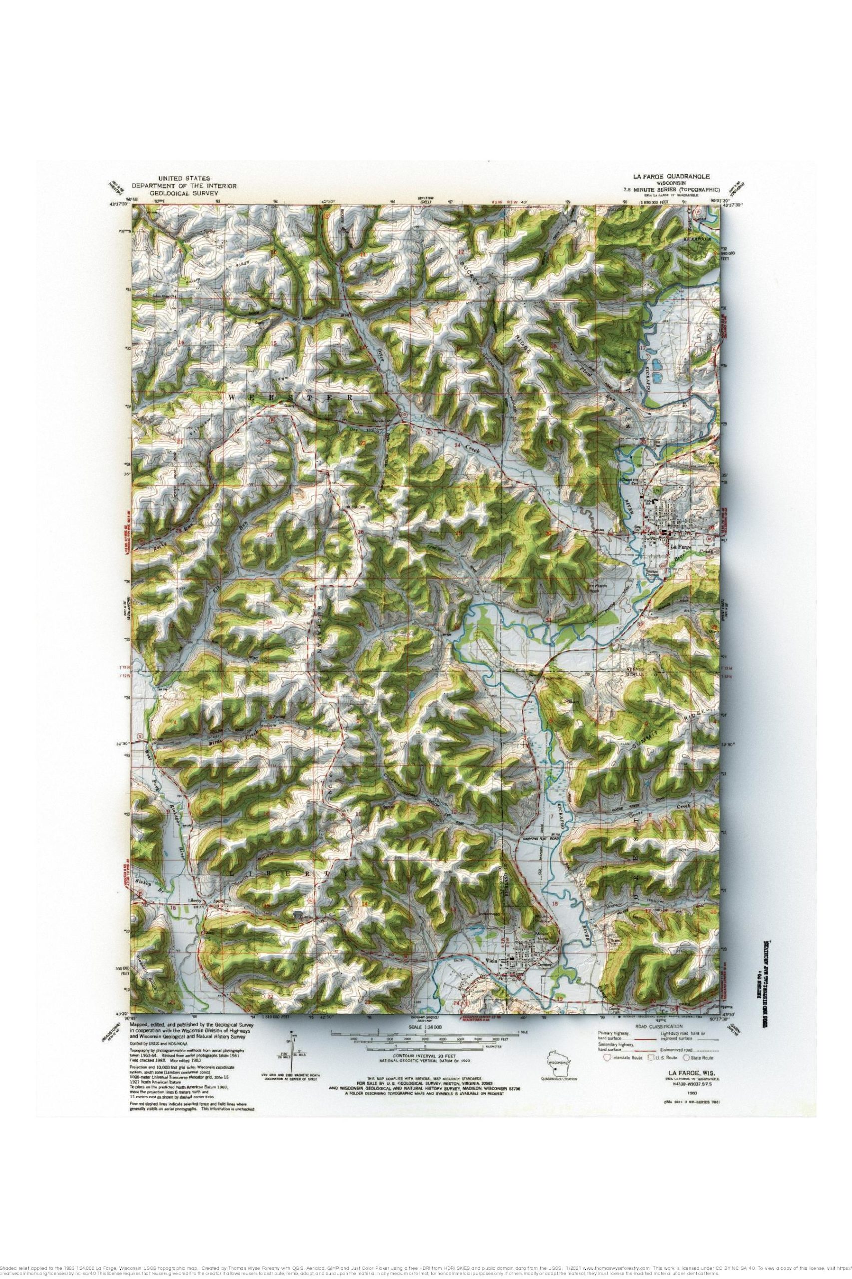
1983 1:24,000 topographic map with shaded relief in 24″ x 36″ layout.

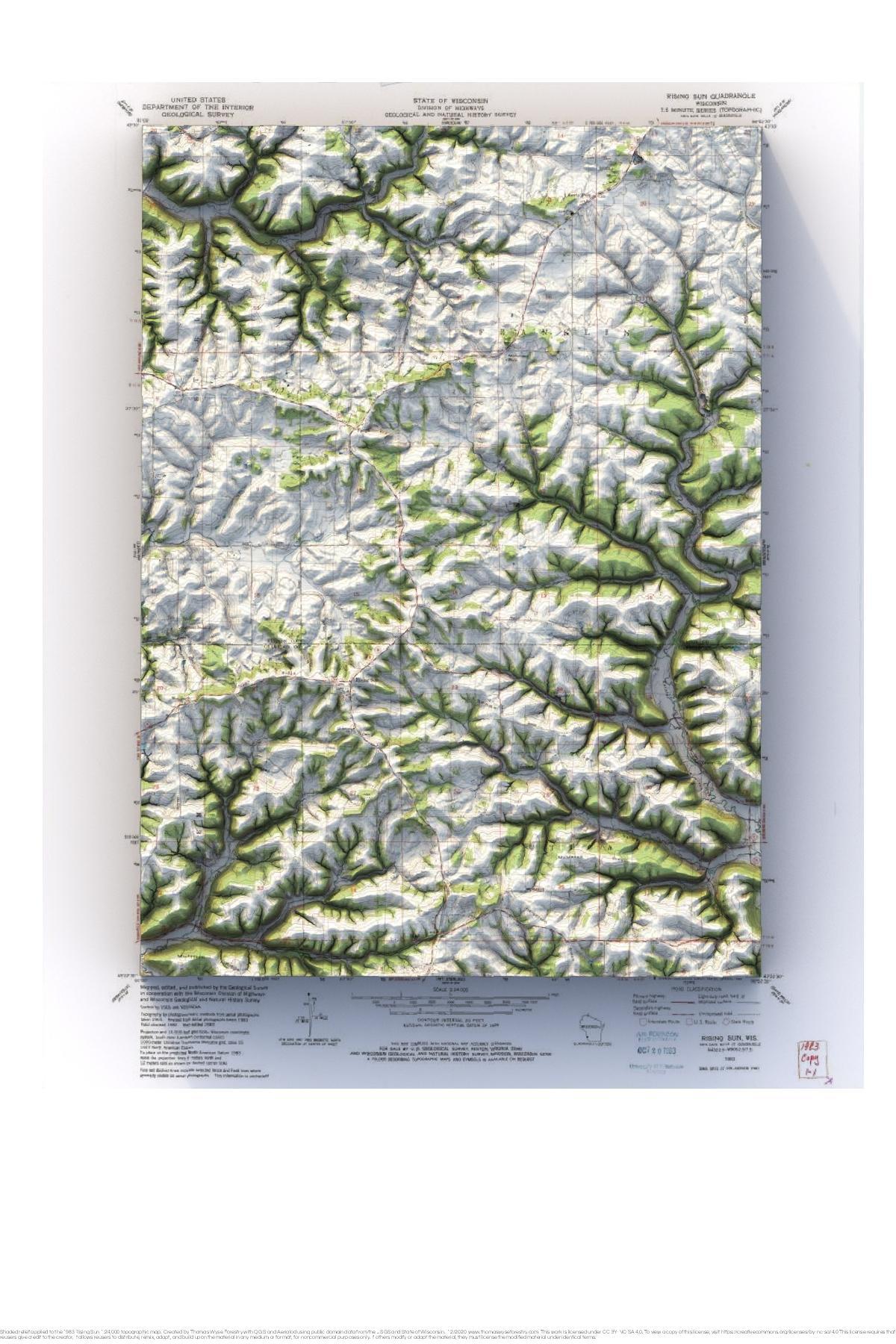
1983 USGS 1:24,000 topographic map with shaded relief in 24″ x 36″ layout.
1983 USGS 1:24,000 topographic map with shaded relief in 24″ x 36″ layout.
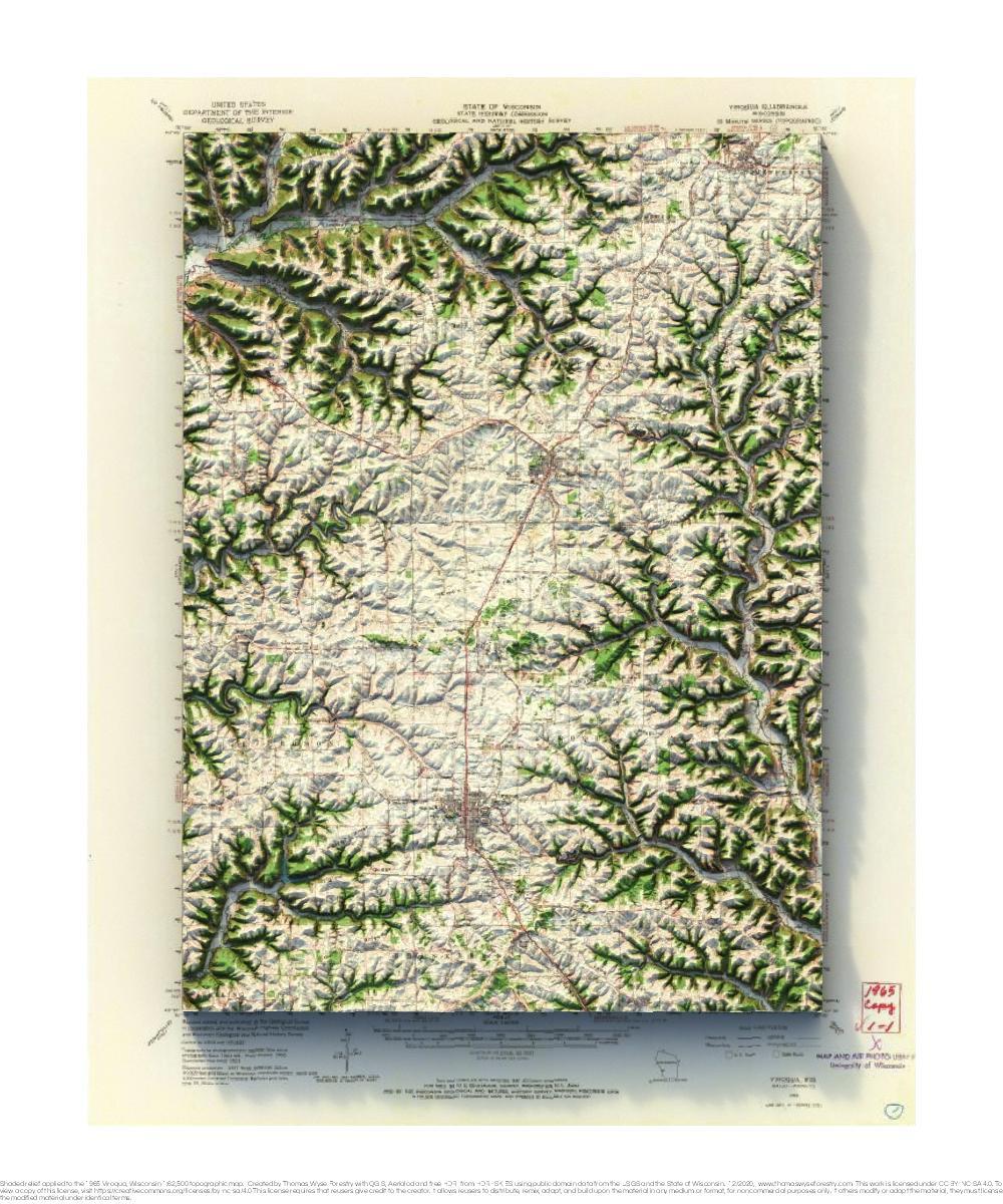
1965 USGS 1:62,500 topographic map with shaded relief in 20″ x 24″ layout.
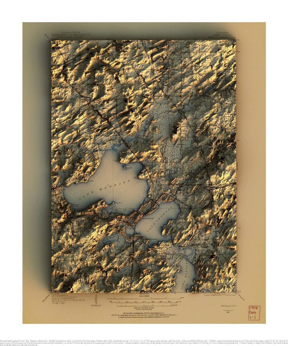
1904 USGS 1:62,500 topographic map with shaded relief in 20″ x 24″ layout. 1959 USGS 1:62,500 topographic map with shaded relief in 20″ x 24″ layout.